After Hurricane Sandy I got more email talking about how the back bays would be changed and how difficult it would be to navigate in them. Navionics and The Marine Trades Association of New Jersey are re-writing the books, or shall I say nautical charts, and you are helping them.
The Sandy Project is a three-day sonar logging event focused along the New Jersey coastline which was heavily damaged during Hurricane Sandy in October 2012. In cooperation with the Marine Trades Association of New Jersey, West Marine, and other businesses, Navionics has organized the Sandy Project to remap the coastline and raise funds for the Hurricane Sandy Recovery & Relief Fund. Navionics has pledged to donate $1 for every mile of sonar logs uploaded during this event, up to $5,000, to the fund.
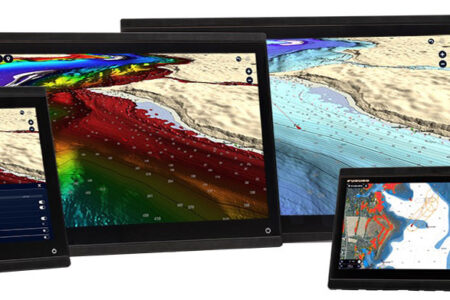
Updated SonarCharts™ can be viewed by anyone on the Navionics WebApp as soon as the new data has been integrated. Customers who own Freshest Data eligible Navionics Platinum+, HotMaps Platinum and Navionics+ charts can download updated SonarCharts™ for free. Customers with Gold or HotMaps Premium can upgrade to Navionics+ by using Navionics Updates to access SonarCharts™ and one year of Freshest Data updates.
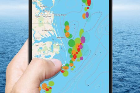
Those of you who have the Navioncs mobile app can use the Edit Map feature to add, delete, or modify objects. These Community Edits are available almost immediately to all other Navionics mobile app users, and can be downloaded to eligible charts and accessed on compatible plotters.
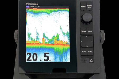
Navionics has come a long way in improving the accuracy of nautical charts. Now in a logical undertaking, they have enlisted the end-users to be a part of improving the scope of sonar charts. The data saved from your own fishing or cruising trips on your Humminbird, Garmin or Raymarine’s chips can easily be incorporated into the continual updates put out by Navionics.
With SonarCharts™, Navionics became the first company in the world to introduce crowd-sourcing to cartography. While the SonarCharts™ layer is made up of data from multiple sources, its evolution over time, incorporating new sonar logs from the boating and fishing community, is revolutionizing cartography.
It’s simple and convenient for anyone to record sonar logs and upload them to navionics.com. A few hours on the water can make a huge difference. A small lake may not be charted at all, or backwater river channels and remote bays may lack detail. With real time crowd-sourced data, Navionics can provide new and updated charts for virtually any area, making updated SonarCharts available for download to eligible Navionics cards. SonarCharts™ is an exceptional value for boaters, because the cartography they own actually improves over time!
Navionics representatives will be on site to kick off the event with how-to seminars. Enjoy free food, drinks and prizes while learning how to help your fellow boaters remap the coast. Attend a seminar Thursday, July 18 or Friday, July 19, from 6pm – 8pm at one of these location.
West Marine, 51 Chambersbridge Rd, Brick, NJ 08723 tel. 732-864-8140
West Marine, 494 Market St, Perth Amboy, NJ 08861-4565 tel. 732-442-5700
West Marine, Somers Point 258 New Rd, Somers Point, NJ 08244-2177 tel. 609-601-0061
Additional Sandy Project Partners:
GMT Electronics, 171 Main St, South River, NJ 08882 tel. 732-651-1213
Lockwood Boat Works, 1825 Hwy #35, South Amboy, NJ 08879 tel. 732-721-1605
Manasquan River Club, 217 Riverside Drive, North Brick, NJ 08724 tel. 732-840-0300
Professional Sportfish Services, 201 Union, Brielle, NJ 08730 tel. 732-258-5224
ProMarine Electronics, 43 Hooper Ave, Atlantic Highlands, NJ 07716 tel. 732-291-3199