Drones have become a valuable tool for boaters and fishermen, not only to record trophies and accomplishments, but as an actual aid to navigation.
Fishing with drones is gaining in popularity. There are many applications that make these devices useful for a variety of fishing and boating situations. As prices decrease and battery life increases, they are becoming more commonplace.
Anglers are using them from shore to fly baits out and drop them into schools of fish. Captains are using them to prospect and locate fish in the open ocean. Everyone is using them for incredible cinematography including stills and videos. They have become so popular that RayMarine has partnered with drone manufacturer DJI to integrate their chartplotter as a flight command screen.
Navigation
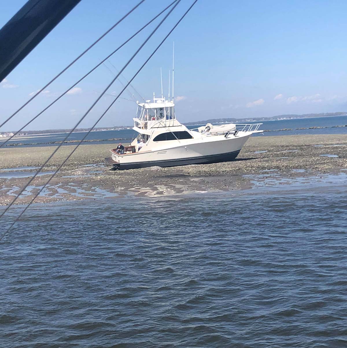
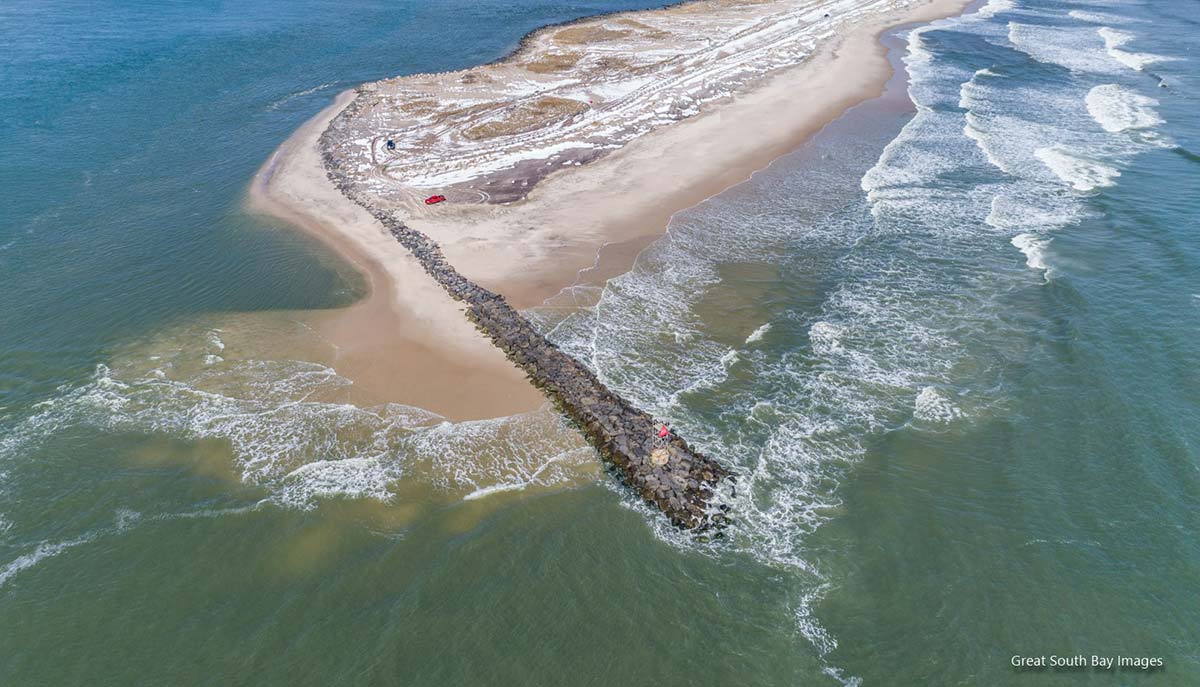
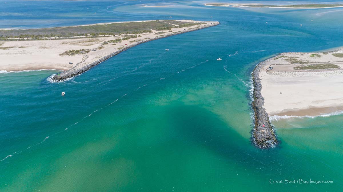
If you navigate from any of our ever-changing South Shore inlets, drones have become a valuable tool for navigation. After a long winter of nor’easters and storms, inlets and sandbars will shift and change in size and shape. Doing an overhead scan to note these changes is a simple task with a drone. If you can access your desired location by land, do so. It is much easier to launch, fly and retrieve your drone from land. If your only option is by boat, bring someone else to run it while you operate the drone. If possible, anchor the boat. Shinnecock Inlet is easily accessible by car with plenty of parking options. Moriches and Fire Island may require a 4×4 or a lengthy walk to get close enough.
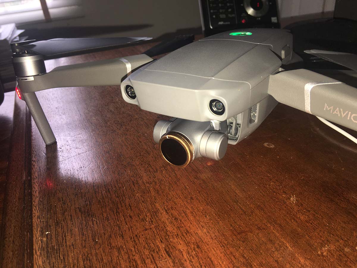
Flying at low tide with bright daylight is optimal. Find the lowest possible tide that lines up with mid-day light. Remember your intended target is below the water, so high sunlight will be best to illuminate it. Equally important is a high-quality polarized filter. If you are on tight budget and can only purchase one, the ND 8 PL offers the most versatility. There are many options with two standouts – Skyreat and Polar Pro. The Skyreat is a little less expensive and may afford you the opportunity to buy a complete set. These filters will allow sub surface features to pop and become more visible (just like good polarized sunglasses).
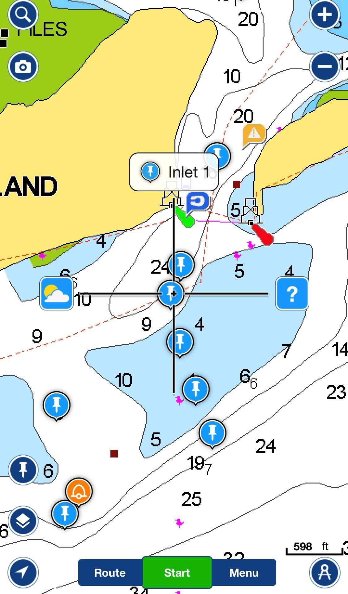
Like birds, the higher the drone is the deeper it will see into the water. As you go higher you see less detail. Flying at various heights while recording will give you a nice mix. Pausing the video and shooting stills will allow you to zoom in and out when viewing them on a computer. Files called SRT or location stamps can be used to determine where each picture is taken. This will help you plot approximate locations of hazards to avoid. The gimbal on the drone should be pointing straight down as the position data will correlate to the drone’s position. This by no means is an exact science and I do not recommend navigating only by this data. This will give you a good idea of what to avoid, but you will need to verify and plot this on your vessel’s chartplotter and confirm with other instruments.
Flying Over Water
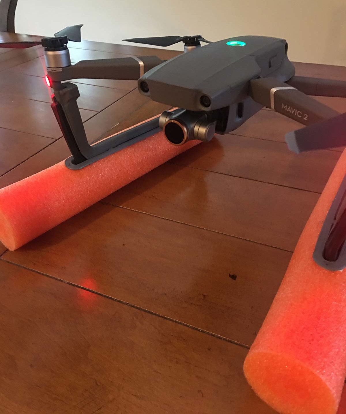
Most important is to practice, and practice often. The more hours of flight time you have logged the better. Watch tutorial videos at home and set your drones primary settings prior to any trip. Invest in a good comprehensive insurance plan. DJI offers “DJI Care.” They are very good at replacing or fixing damaged drones under this insurance. There is one caveat, you must return the drone to receive a replacement. If you crash into the water that maybe impossible. When over any water I personally fly with floats. Two viable options are; Styrofoam ball floats or pontoons (pool noodles). These will not impact your flight time or maneuverability. It is not recommended to take off and or land from water, especially moving saltwater.
The purpose of these devices is twofold. First is optics. It is very hard to spot your drone in intense light. Brightly colored floats give it a vibrant look, which will assist in spotting and watching your drone (I use neon orange). If equipped, turning on the drone’s bottom light works well too. The second is recovery. If the drone goes down and floats it may be ruined, but you can at least recover it. This will enable you to send it in for repair or replacement. Remember you must have the damaged drone in order to replace it. If possible, it is also a good idea to have a recovery plan. If you fly from land and don’t have access to a boat, at minimum you should have a fully charged handheld VHF. If there is a vessel in proximity you may be able to raise them for assistance on the radio.
When flying anytime, but especially over water, you must take into consideration wind speed and direction. The dashboard on most drones will calculate flight time, battery life, distance and warn you when it is time to fly home. What they don’t do is take into consideration the wind. If you fly with the wind on the way out and get a low battery warning, there may not be enough battery life to fight the wind on the return trip. Keeping a wider safety margin will ensure you always have enough power to make it home.
Taking off and landing on a boat at anchor or moving is always tricky! Even at anchor the boat is moving, swaying side to side and or up and down. Keep this mind and do not blindly use return to home feature. Depending on anchor scope and tide, your take off position can and will vary greatly from your landing position. Return to boat on RayMarine is a much safer option, or fly the drone manually with constant line of sight to landing area. Keeping the deck clear is a must. Any obstacle that can be removed and stowed should be. Flags, outriggers, antennas, and fishing rods can all be potential landing hazards. Plan your drones take off so that if the wind catches it the craft flies way from hazards not towards them. Use the same theory for landing, you don’t want a gust of wind to slam the drone into a person or the boat.
Many drone enthusiasts have swapped out stock props for quieter options. The theory here is the quieter props have less friction and improve maneuverability and flight time. They are also a great option when filming sporting events or any activity involving people as they are less intrusive. When flying in nature, opting back to noisier props may be beneficial. With many species of birds in and around the inlets a noisy prop may spook them away from your drone. An encounter with birds will harm the bird and ultimately crash your drone, so stay as far away as possible and use your louder props.
Spotters
If new to the drone scene make sure you take time to learn the ins and outs of flying and retrieving it in a controlled safe environment. Never try to run your boat and drone simultaneously. They both require 100 percent of your attention. When flying a drone it’s a great idea to have a spotter. Assign a person to constantly watch the drone as the pilot is fiddling with screens and controllers. This is the best practice to ensure your drone flies safely and without incident. This means three people; captain (running the boat), pilot (flying the drone) and a spotter.
If new to Drones, visit The Federal Aviation Administration’s website at www.FAA.gov/uas/getting_started for requirements and restrictions when it comes to flying your drone.
Drones have become a valuable tool for boaters and fishermen, not only to record trophies and accomplishments, but as an actual aid to navigation. Keep in mind that despite all electronics, nothing beats a good set of eyes, keen observation and common sense. Use feedback from your electronics to confirm safe passage. Monitor your depth with sonar, location with chart plotters and radar, and use visual observation to interpret this data. Be safe and enjoy your time on the water.