Elephant’s Trunk
As time passes, some old school hot spots get lost in the shuffle, but one in particular trumpets its loud, boisterous call to attract new anglers – the Elephant’s Trunk.
As time passes, some old school hot spots get lost in the shuffle, but one in particular trumpets its loud, boisterous call to attract new anglers – the Elephant’s Trunk.
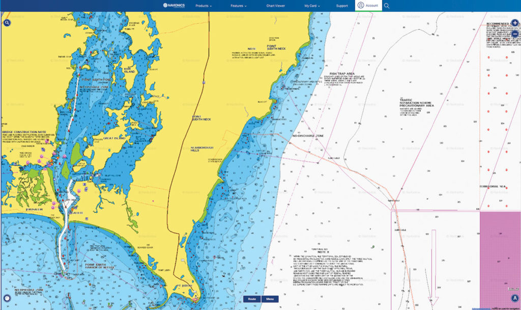
The rocky shore of Narragansett comprises a series of striper hot spots that begin at Point Judith and continue northeast into the mouth of Narragansett Bay.
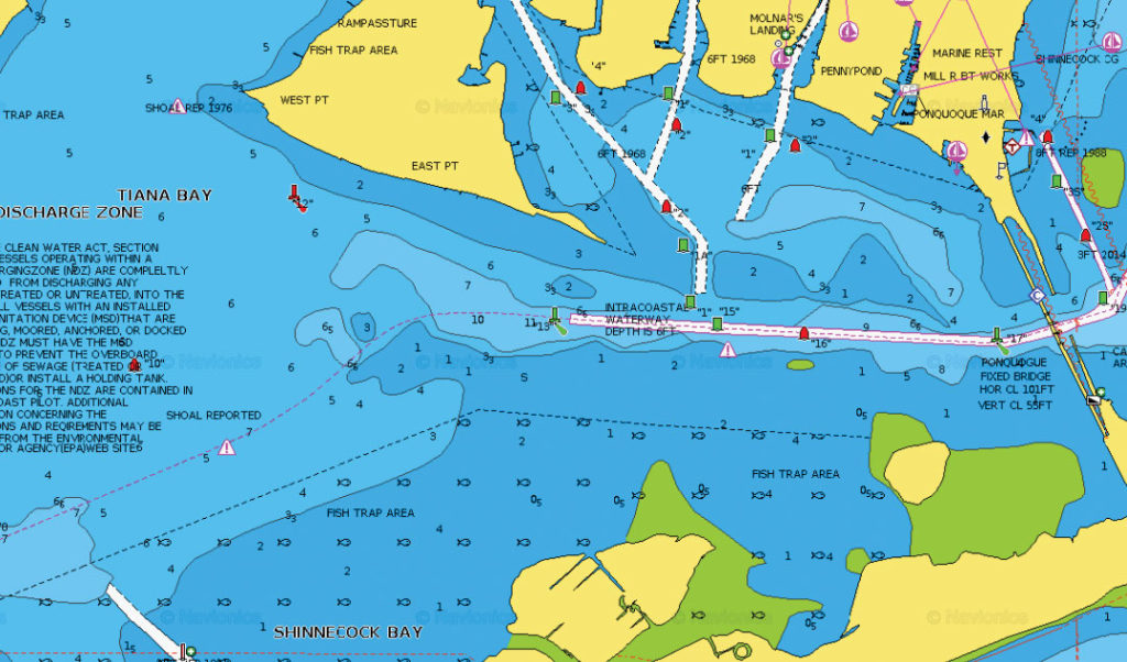
“Go where the locals go,” and when the going gets tough, the locals head for a little known area called Rampasture, which often produces some exceptional fluke action when other local areas fail.
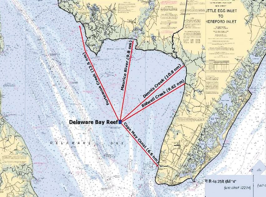
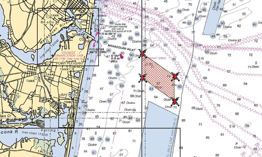
With 18 artificial reef sites deployed and maintained by the State of New Jersey, the Division of Fish and Wildlife decided on taking a calculated chance by constructing a new reef, not offshore like the rest of the Garden State’s artificial reefs, but number 19, the Delaware Bay Reef.
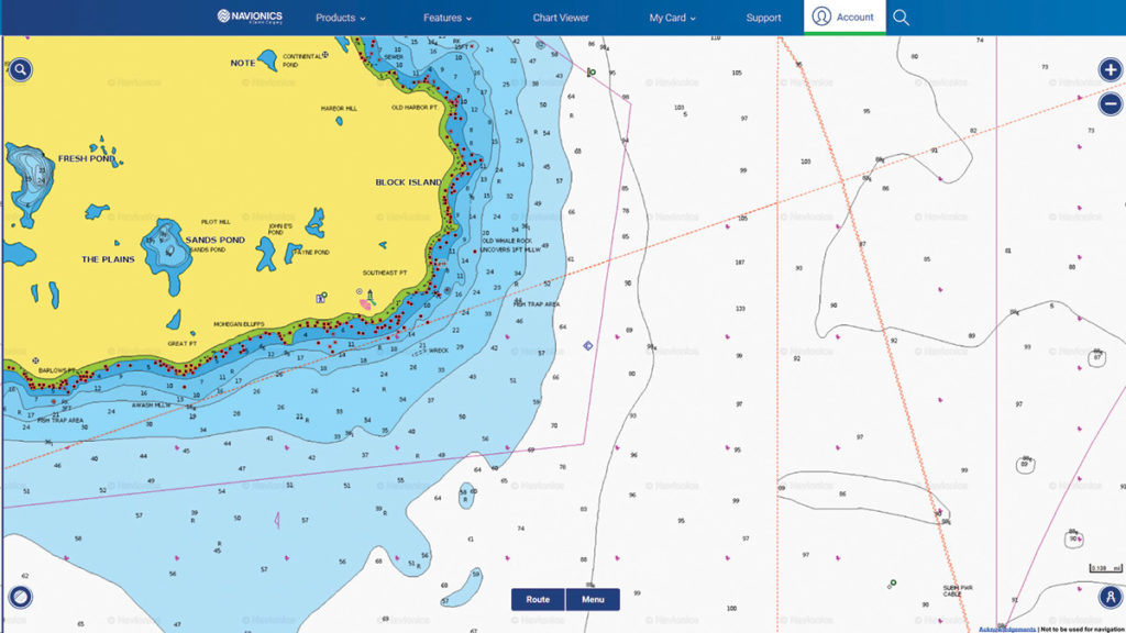
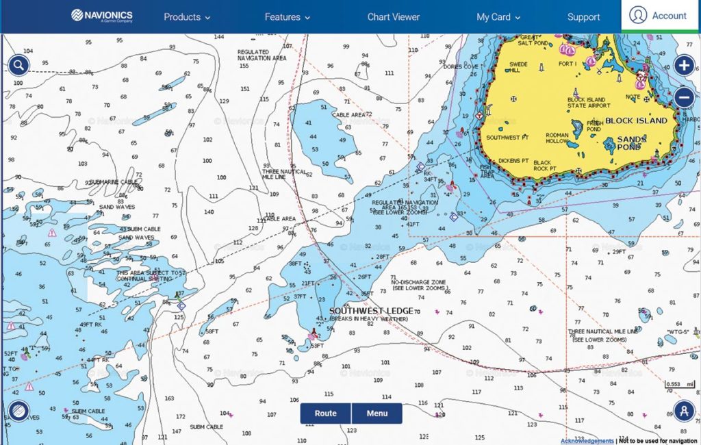
Continuing our tour of Block Island’s fishy structure, the Southeast corner of the island offers great variety throughout the seasons.
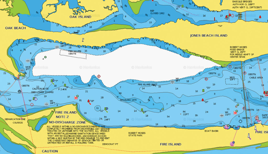
Stretching from the west side of the Robert Moses Bridge to the Sore Thumb Pocket along the northern shore of Fire Island Inlet, on the barrier island separating the Atlantic from Great South Bay, lies the sleepy community of Oak Beach.
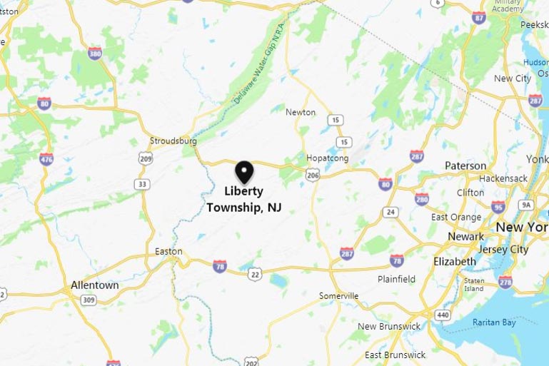
Mountain Lake gets its name from Jenny Jump Mountain overlooking its glacial 122 acres. Located in Liberty Township, Warren County, its maximum depth is 38 feet, mean depth 17 feet.
A hotbed of summer striper action, this spot is more than just bass country.

Moriches Bay offers anglers numerous opportunities for a variety of species. You can fish the Elbow area for stripers, triggerfish and fluke.
Talk about easy access for the average boating angler.
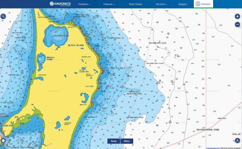
Located at the northeast corner of Block Island, Clay Head offers action from spring through fall on a variety of species.
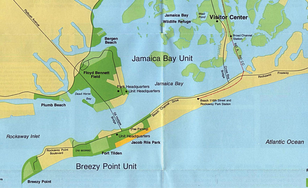
Breezy Point is the terminus of the Rockaway Peninsula.
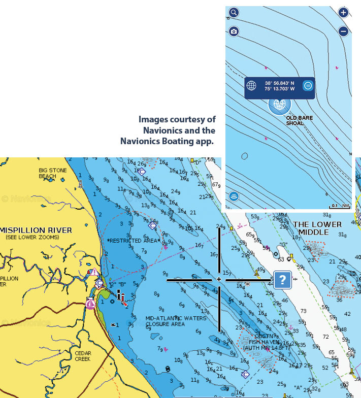
Old Bare Shoal (38 56.843N / 75 13.703W) lies between the Green Can (38 57.004N / 75 15.008W) and Reef Site 5 (38 54.005N / 75 11.008W) on the Delaware side of the bay, rising from 48 feet in the Anchorage to 3 feet at the top before dropping back to 23 feet in the Broadkill Slough (38 54.933N / 75 13.043W).
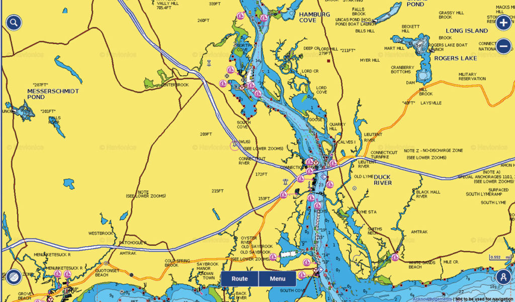
Whether you get them coming or going, the lower stretch of the Connecticut River is a great spot to intercept that first cow striped bass of the season.
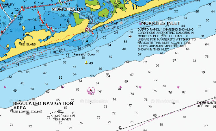
Laying on a sandy lair just four miles dead south of Moriches Inlet in 95 feet of water is a mysterious steel schooner known as the Sea Wolf or better known by local divers and fishermen as the South Wreck.
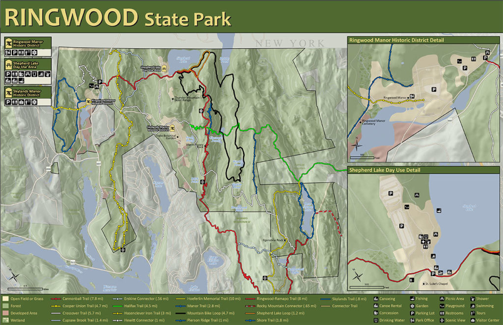
Shepherd Lake is tucked away among the mountains of northern Passaic County, the northern shoreline right on New York’s border in Ringwood State Park.