Interpreting wave movement and water patterns can keep you safer and help you catch more fish.
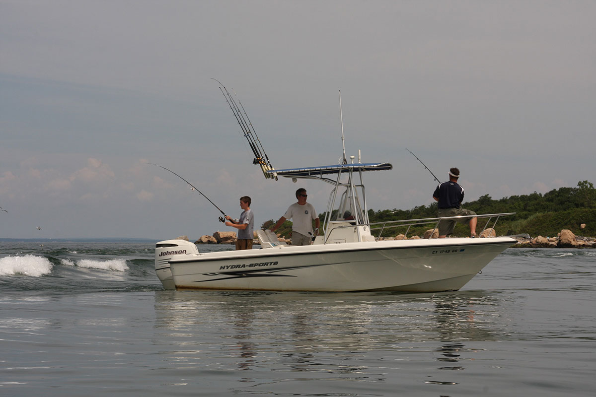
One day last fall, I was casting a diving plug off the Charlestown Breachway jetty on a strong ebb tide. By late morning, the wind had increased to 10 to 15 knots from the southwest accompanied by manageable whitecaps in open water. The outflow on the moon tide abutted the wind, which stacked up tall, standing waves at the breachway entrance.
Seeing the extremely challenging conditions, some boat anglers turned around and headed back into the salt pond. Others, however, had enough confidence in their vessel and their ability to read the water to charge forward, steering with one hand, and jockeying the throttle with the other, individually navigating the 4- to 5-foot seas. This spectacle made the anglers on the jetty pause to watch and see if those craft made it through the surf line without capsizing.
Wave Action
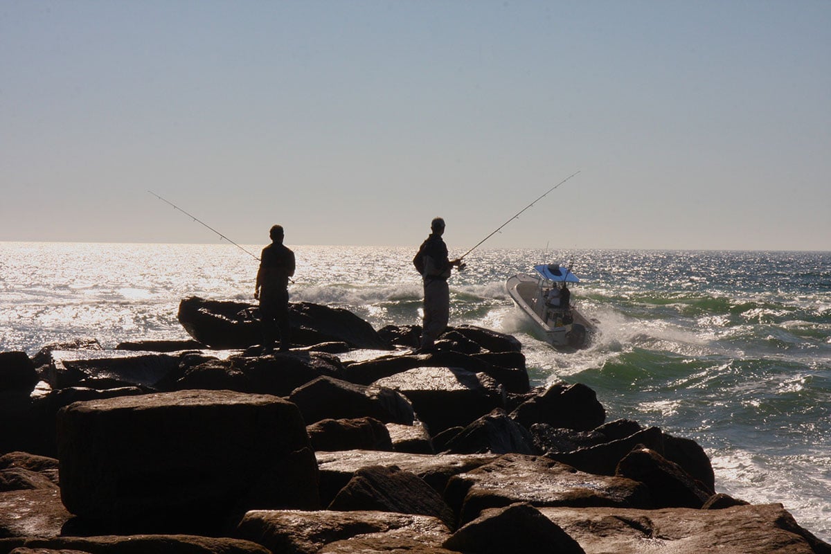
Breachways spewing from salt ponds or outlets emptying rivers into open water are notorious for rough conditions, especially during an opposing breeze. Stiff onshore winds can create large rollers, which crash over the front ends of these jetties, making for dangerous conditions for land-based anglers.
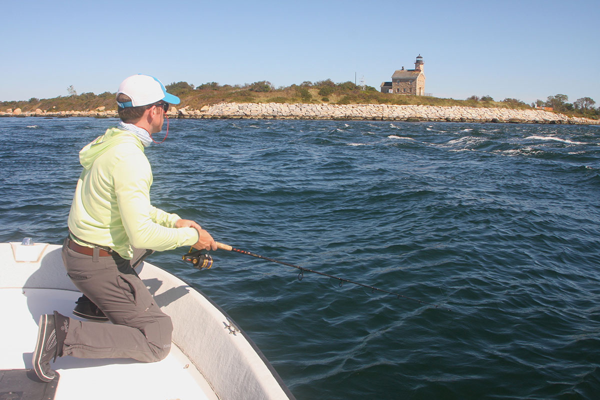
But even riskier than fishing from a jetty is attempting to navigate a vessel through the breachway rip into calmer open water beyond. The defining line between what is “too rough” and what is “doable” is a thin one, which requires operator experience and a seaworthy vessel. Although expert anglers don’t recommend navigating through or fishing these breachways if sea conditions aren’t safe, many pros prefer to see some rough water around the outlet, which washes out and disorients baitfish and therefore attracts predators.
Waves form on open water because the wind’s energy is transferred to the sea surface. The factors determining wave size include the wind speed, the duration it blows, and the distance over which it blows, called “fetch.” The larger the waves become, the more vertical surface area is available—visualize a sail—to capture more wind. Therefore, wave size increases exponentially. For example, if a 15-knot wind on Long Island Sound creates 1-foot seas, a 30-knot wind doesn’t create 2-foot seas, it creates 3- to 4-foot seas. For general navigating knowledge, waves start to whitecap at about 13 knots.
The important measurable parts of a wave are its wavelength (the horizontal distance from crest to crest), its amplitude (the vertical distance from a trough to its crest), and its velocity (the speed at which wave crests move across the water).
Relatively small waves move up to about 6 miles/hour and roll ashore about once every 3 to 5 seconds. Conversely, large waves can move about five times faster—about 30 miles/hour—but because their wavelengths are so much longer, they arrive less often—about once every 15 seconds. Knowing this information helps you determine timing when running through a breachway or outlet or when casting to a shoreline from a boat.
A wave’s “base” is the depth of disturbance of the water beneath a wave. Because open ocean is deep, the wave base does not nearly reach the seabed. However, as ocean waves approach the shallows of a shoreline, the wave’s energy begins to interact with the bottom. This bottom “drag” slows the lower (underwater) half of the wave due to friction, which results in the wave amplitude (height) increasing and wavelength decreasing; in other words, the waves become steeper, faster, and correspondingly more dangerous along the beach or inlet.
The further result of the interaction with sea floor is that the waves lean forward because the top half of the wave is now moving faster than the base of the wave, which is slowed from the bottom structure. The ocean roller can no longer support itself, which causes it to topple forward, break, and crash ashore as a safety threat. Ocean waves, breaking as a surf, increase up to 1-1/2 times their deepwater height. Watching for a storm on the horizon doesn’t always predict ensuing wave height because offshore-generated waves will significantly outrun the storms that created them many miles away, so they may be present without notice.
As most experienced surfcasters know, stripers and bluefish often hold along the bottom shelf where the rollers begin to interact with the sandy or rocky bottom before the waves reach the breaking point. It’s in this slightly turbulent water where baitfish gather to feed on tiny forage stirred up from the bottom. And, naturally, this is where the predators stalk the baitfish.
Rogue & Average Waves
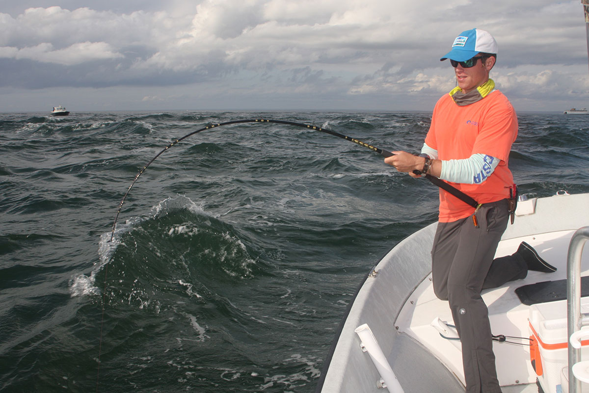
Another risk to the boater or surfcaster is a rogue wave. A rogue wave is one that can be double the size of surrounding waves; they sometimes approach from an inconsistent direction, and they are unpredictable. Rogue waves are typically created by swells or large whitecaps, which can travel at different speeds and angles to the prevailing waves and pass through them. This can cause their troughs, crests, and lengths to merge and reinforce each other, which combine to create a massive singular wave.
For the boater navigating on a relatively sheltered water body like Long Island Sound or Buzzards Bay, smaller rogue waves can be created simply by a large boat wake meeting up with a wind-driven wave. Whether you’re fishing from a jetty, beach, or vessel, rogue waves are usually short-lived but are dangerous and unforeseeable.
When you see a marine forecast that lists standard or average wave height of, say, 3 feet, that means most of the waves will be less than 3 feet, but to obtain that “average” statistic a few waves will be one-and-a-half times or greater than 3 feet; in other words, 4 footers would not be uncommon, especially when the wind is opposing the current. During a 3-foot-average-seas forecast, you can expect the possibility of 5- to 6-footers when a stiff breeze opposes the current along a major rips like the Race or Plum Gut, especially on a moon tide, which is the same basic condition as a discharging outlet abutting a headwind.
Targeting Structure
On calm days when wave action is absent, an experienced angler still knows how to read water based on its movement around or over structure. “Structure” can include shoals, submerged spits, boulder fields, ledges, and reefs.
“I always prefer targeting shoreline structure where the waves are pushing onshore,” says Capt. Chris Elser, a top guide in southwestern Connecticut with over 30 years of experience (ct-fishing.com), “small bait gets balled up near any structure, and rocky structure is a good option to blind cast to. Take note of the shoreline makeup and contours, if it’s steep and rocky it’s a perfect scenario to blind cast to a subsurface boulder field that will have multiple ambush points for predators to corner and chase baitfish. Conversely, if the shore has a gentle slope so will the bottom in front of it.”
Captain Elser advises that when approaching rocky shorelines to always be cautious and pay close attention to your chartplotter that has current updates to the software. Charts are amazingly accurate, but it’s still a good idea to have a companion act as a bow spotter when approaching very close to rocky shorelines because a stray submerged tree limb or boulder could be lurking below. This is when a trolling motor is handy, but if you pay attention one isn’t always necessary.
Boaters get into trouble in these areas, according to Elser, when there’s an onshore chop because it can be easy to get lost in time and position either fighting a fish or blind-casting. In this scenario, Elser always keeps the engine idling and if he’s alone he stays close to the helm as the boat drifts toward the rocky shoreline.
“Reading the water’s surface,” says Elser, “leads an angler to where the current ‘breaks’ are as well as underwater boulders or high points and ultimately fish. When you notice a whirlpool-like motion, boil, or gentle rip line, this tells you there is subsurface structure and most likely at least one large boulder or ledge which is a magnet to fish in any estuary system.”
“I like to look for ‘seams’ or current breaks on the surface, and then I specifically target the slower current side of these seams casting across and slightly up current then working my lure back to the boat. Seams on the surface are caused by depth and current speed changes, and they typically occur near any outflows but most notable are those along jetties or breakwalls near an estuary or river system. Bait tends to hold on the slower current side of the current breaks and predatory fish like stripers and bluefish will be in the same zone.
When Captain Elser fishes a rocky shoreline he scans the surface for “nervous” water. He says that nervous water is when there’s an obvious difference in chop frequency compared to the surrounding area. Nervous surface water is typically caused by schools of bait (such as sand eels or bunker) because of the volume of bait underwater the appearance of the water surface changes. Nervous water can also indicate structure below like a reef. Another sign of bait is an obvious calm area or slick, which is most often caused by oils released from a bunker school just beneath the surface. For both safety and fishing productivity, anglers should look for any sign on the water’s surface that appears different from its surrounding area.
Transient Structure
Saltwater flyfishing expert and outdoor writer Vince Battista says that almost every angler—whether they target striped bass, or another inshore gamefish—knows that fish will congregate around submerged structure. While these provide shelter or easier swimming conditions, they have the bonus of predictably holding baitfish.
“But other temporary forms of structure,” says Battista—“what some anglers call ‘intermittent’ or ‘transient’ structure—are short-lived features of the waterscape that attract fish, such as an eddy behind a standing wave on an outgoing tide or piece of debris like a floating log. Knowledge of—and the ability to spot—these transient structures are critical for anglers targeting big fish.
“While this is a vague concept, these transient structures can be defined as features that aren’t fixed to the ground but are readable, and either: (1) provide cover, (2) attract microorganisms upon which baitfish (and thus gamefish) can feed, or (3) facilitate opportunistic feeding by predatory fish.
“Other examples of transient structure include floating mats of vegetation, undercut banks, shadows, light-beams from bridge pilings, and even backwash from boat traffic. Unlike typical examples of structure like southern mangrove roots or northern boulder fields, transient structures such as floating debris might only attract fish for a single tide, or only when a very specific set of fishing conditions are met. But they’re sure worth finding and exploring.”
Taking the time to learn to read what the water is telling you about current and structure will help any angler find and catch more fish. Learning to make sense of the marine forecast and how the waves are reacting to certain situations can save you some serious navigational headaches, or even your life.