 Navionics, one of the major cartography providers to coastal anglers, is owned by Garmin, one of the leading manufacturers of marine electronics. This corporate marriage has created some very interesting synergies. For 2020, there are a few new introductions from Navionics, one for their cartography and the other is for their popular Boating App that is used on a variety of portable Apple and Android devices.
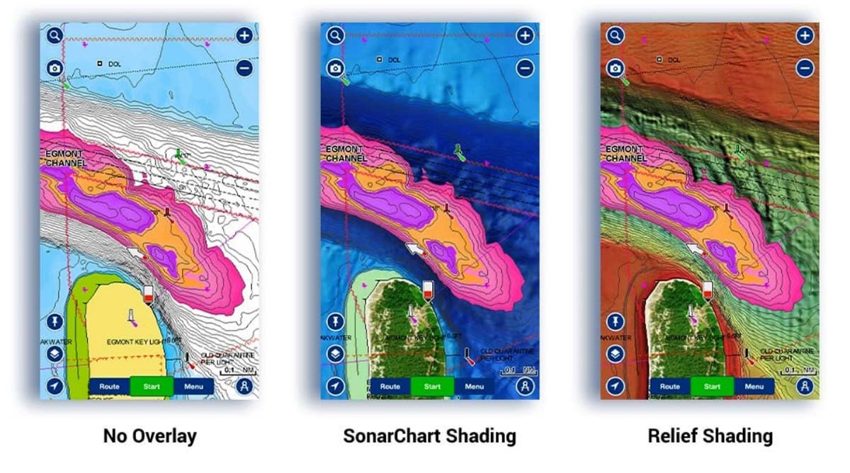
For coastal and inland boat owners who want to know as much as possible about depths and bottom structure, Navionics SonarChart Shading presents a detailed rendering of the seafloor and lake bottoms and it’s better than ever. Now available within North America, this update to SonarChart Shading content, derived from a more recent version of SonarChart, incorporates depth data from a massive amount of sonar logs contributed in the past year and offers expanded coverage further from shore. Additionally, satellite imagery has been carefully reviewed and optimized using higher quality images to provide a clearer top-down view and better situational awareness above the waterline. When used on Navionics’ Platinum+ and HotMaps Platinum cartography products, satellite overlay and SonarChart Shading forms a single overlay which can be updated using the Navionics Chart Installer. An active subscription is required to install these updates.
Navionics Boating App Update
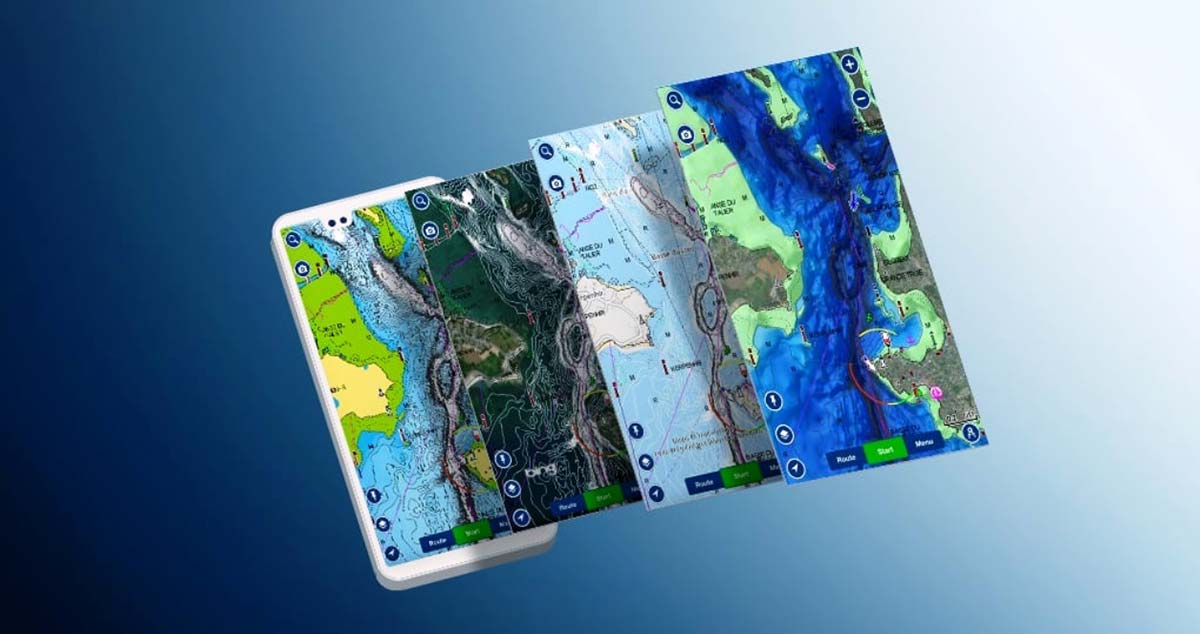
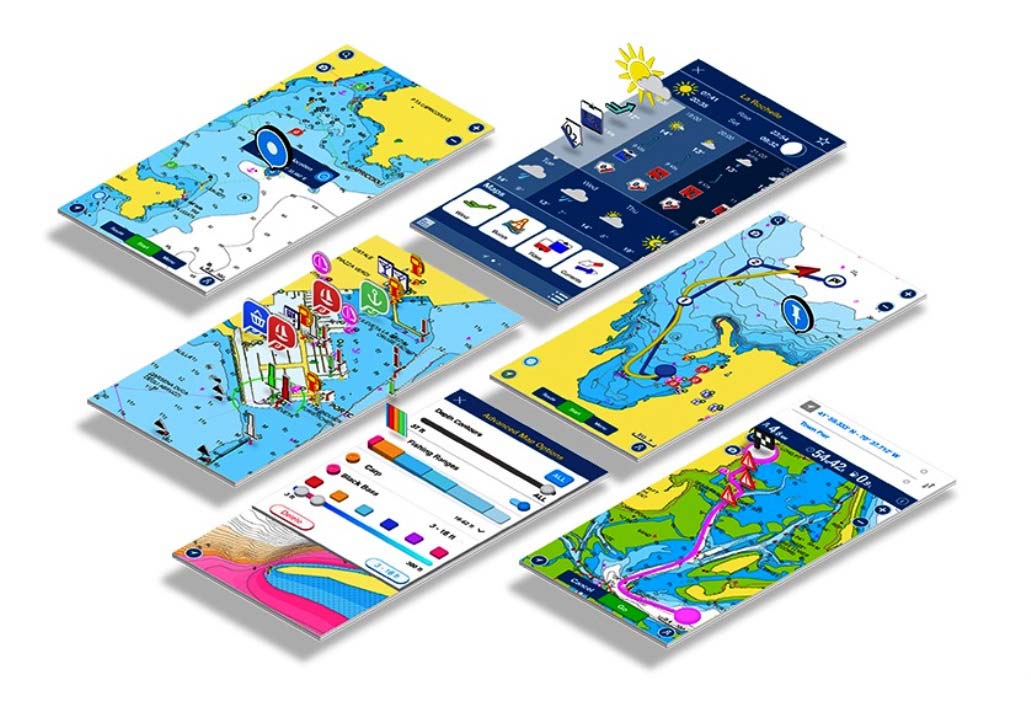
The new update of the 2020 Navionics Boating app comes with a multiple chart-overlay option that allows you to use different content combinations and has been enhanced further with Navionics Satellite Overlay with SonarChart Shading.
This new 2020 version of the Boating app comes with the redesigned section in Map Options. It includes a multiple chart-overlay option that allows you to easily and intuitively choose among different chart layer-overlay combinations. Satellite Overlay with SonarChart Shading was launched last year in Navionics’ plotter cards and has now been added to the overlays offered in the Boating app. Customers with an active subscription need only to download their area of interest, turn on the overlay and start exploring. As coverage areas are released, customers who own the Navionics Boating app, Platinum+ or HotMaps Platinum charts with an active subscription will be able to download the updated overlay. You can combine it with chart layers (Nautical and SonarChart) to provide a unique perspective of underwater topography at a glance.
The overlay is made of an updated and optimized high-resolution satellite imagery and a detailed rendering of the seafloor and lake bottoms, sourced from SonarChart, the Navionics HD bathymetry layer. Users can clearly see channels, drop-offs and other structures over a wide area for a better understanding of the seafloor. You can search the map for visual cues to identify fish-holding structures on inland lakes and coastal fisheries.
To access the new overlay, you’ll need to download it, and here’s how:
- Go to Menu>Download maps
- Define the area for which you want to download the overlay
- Tap on the “+” button
- Select SonarChart™ Shading
- Tap Download
To overlay it over a chart layer, just go to Menu>Map Option and select SonarChart Shading.
In order to download and display Satellite Overlay with SonarChart Shading, you need to have an active subscription. Once the subscription expires, the overlay won’t be available anymore, even in the downloaded areas. Before you download or update the app, know that Navionics has also changed the route color from blue to magenta for better viewing, especially when SonarChart Shading is active. They have also added some cool new marker icons.
If you already have an older version of the Boating app, to get these new features, simply update it to the latest version.
– For Apple devices, on your mobile device, go to the App Store>Account>Available Updates.
– For Android devices, on your device, go to Google Play>Menu>«My apps & games»
Combining the easy-to-interpret, clearer view of bottom structure provided by the overlays with the multiple depth ranges of Fishing Ranges will definitely help you to catch more fish. Users will be able to spot fish holding areas and easily identify their depth at a glance. Once you have updated the app go to Menu>Map Options to start combining the two features. Old apps are no longer being updated, while the new one has so many new features to discover. The switch is easy, pain free and you get to upgrade it for free, keep all of your existing charts, data and active subscriptions, plus you’ll be eligible to continue getting new features and updates.
If you don’t have the Navionics Boating app yet, download it for free and enjoy a trial of all their charts and features. Just go to the Navionics website at www.navionics.com.