The number one question on every angler’s mind is “Where are the fish?” This same question is also extremely important to researchers and fisheries managers. For anglers, having this knowledge could potentially translate into a record catch. For researchers and fisheries biologists, possessing this data can help them better manage fish stocks.
Until recently, the answer to this question was only found after fish are physically caught. For anglers, this means thoroughly searching beaches, flats, wrecks and other fish havens. Researchers and fisheries biologists typically try to answer this question through a series of trawl and seine surveys. Although both methods can be effective, they are very time consuming and do not always produce results. If no fish are caught, both groups are still left scratching their heads as to where the fish could be.
In an attempt to answer this question, people began tagging fish in the early 1900s. These first tags were modeled after those used by farmers to keep track of their livestock. Once a fish is caught, information such as length, weight and location caught is recorded. Before the fish is released, a plastic tag that contained an ID number and the contact information for the tagger is attached to the fish. The tagger hopes that sometime in the future, someone else will catch this fish and share with them the fish’s current size and where it was caught. This allows the tagger to see how much the fish had grown over that period of time and where it traveled to.
Although simple, these tags are still the primary way of tracking fish throughout the world’s oceans. Their ease of use enables all anglers to get involved in fish tagging, adding a fun way to learn more about the fish we release. Tags are readily available through organizations such as the Littoral Society (www.littoralsociety.org) and NOAA’s Apex Predator Program (nefsc.noaa.gov/nefsc/Narragansett/sharks/). A negative to the tag is that the fish must be recaptured in order to obtain any data.
A few years back, while tagging sharks with my good friend Capt. Greg Metzger of the Long Island Shark Collaboration (@LISharks), we caught a mako while fishing approximately five miles south of Shinnecock Inlet and tagged it with a NOAA Apex Predator Tag. A year and seven months later, that same mako was caught by a commercial longline fisherman off the coast of Africa, more than two thousand miles from where it was first caught. Not only did we learn that the shark traveled a great distance, it grew more than a foot in length during that time. Unfortunately, we only have these two data points for this shark. We do not know where it traveled in between those two data points. Did it make multiple trips or did it take that long to get there? Where did it spend most of its time, at the surface or at great depth? Until now, these questions remained a mystery.
Last summer, I was fortunate to be part of a team of researchers tagging young of the year white sharks off of Montauk Point with OCEARCH. An extremely successful expedition, the team tagged nine juvenile white sharks over a period of two weeks. In addition to receiving a NOAA Apex Predator tag, OCEARCH attaches a Smart Position and Temperature (SPOT) tag to the dorsal fin of each shark they capture. With a built in computer, SPOT tags can collect a variety of data such as location, temperature and depth. Unlike the plastic tags, SPOT tags do not need to be recaptured to get this data. Rather the tag has a powerful transmitter that sends a signal to a satellite each time the tag breaks the surface of the water, which is then emailed directly to the researcher. This allows us to see the near real-time movements of each of the sharks they tag (www.OCEARCH.org).
These SPOT tags have given us far more information than we could have ever imagined receiving from the standard plastic tags. However, these tags still have many limitations. In order for a SPOT tag to work, the tag must break the surface of the water. What about species that spend little to no time at the surface? A SPOT tag would be useless in this circumstance.
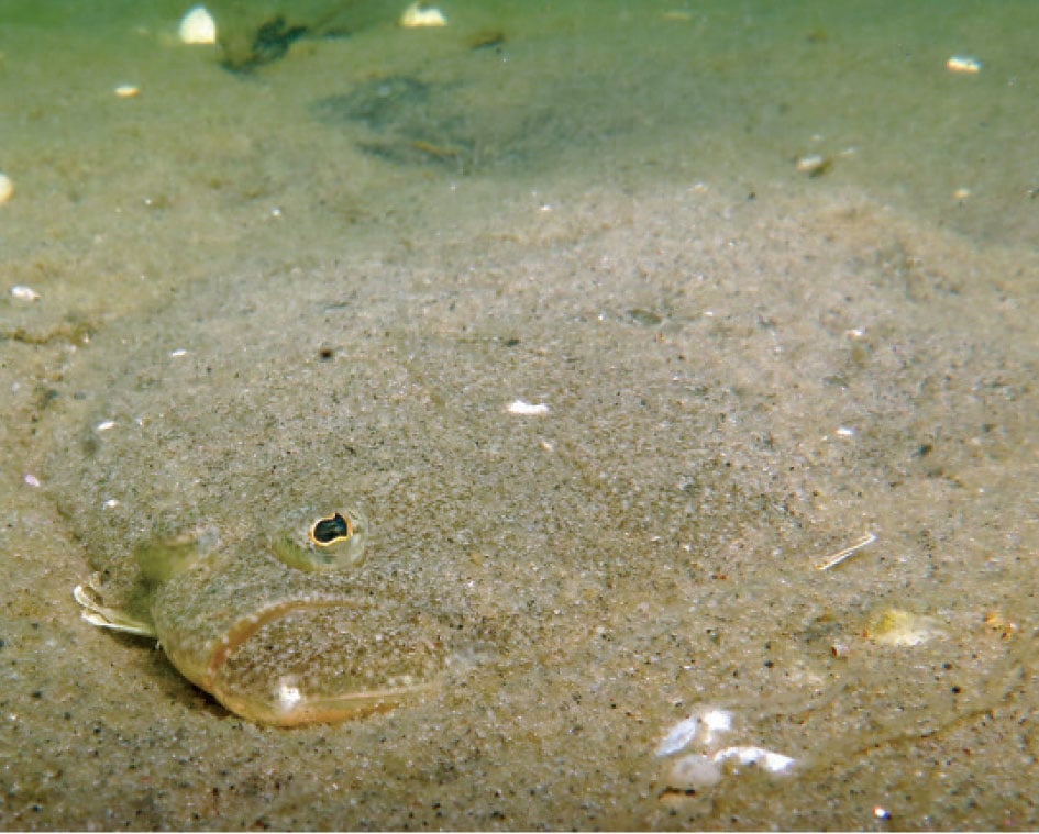
Working at Stony Brook University, I am fortunate to be surrounded by cutting edge marine research. As a fisherman, one project that really caught my attention is a summer flounder (aka fluke) tagging project being done by one of our PhD students, Sara Cernadas-Martín in collaboration with the Shinnecock Bay Restoration Program (ShiRP, www.shinnecockbay.org) and under the guidance of Dr. Ellen K. Pikitch. Sara is looking to answer two questions. Do summer flounder have a tendency to come back to the same bay every summer, even though they hatch in the ocean? And what factors trigger their migration back to the open ocean? The answer to this question might shed some light on the debate on whether to manage summer flounder as a single stock species or a multiple stock. Thus, the results of this research could potentially have a great impact on the actual fishing regulations on this species.
Plastic tags are commonly used for tagging flounder, but they are not capable of collecting or storing the data needed to answer either one of these questions. As for using SPOT tags, a summer flounder spends its life swimming along the bottom, only breaking the surface when caught by an angler. Because of this benthic lifestyle, a SPOT tag would collect data, but the researcher would not be able to retrieve the information unless the fish is recaptured.
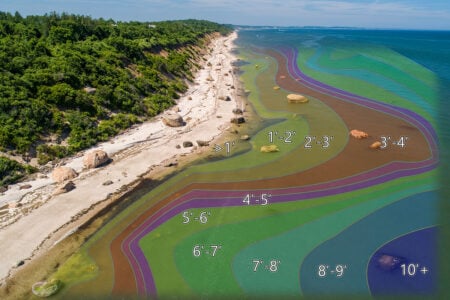
In an attempt to answer her questions, Sara is using acoustic transmitters. These transmitters are attached to the fluke like a regular tag, but will emit an acoustic signal or “ping” every few seconds or minutes. This ping can be detected by submerged receivers that specialize in recording these pings. When a tagged summer flounder swims within range of one of the receivers Sara has anchored to the bottom of the bay, the ping is recorded and stored until she returns to retrieve the receivers. Due to budget limitations, she was only able to place out eight; four located in Shinnecock inlet, two in the Shinnecock Canal and two in western Shinnecock Bay near the entrance to the Quogue Canal. Luckily for Sara, the “ping” from her transmitters can be picked-up by receivers that have been placed out by other researchers. With an array of these listening devices throughout the world’s oceans, Sara can continue to collect data even after her fish leave the bay. An example of this happened in 2014 when one of her flounder “pinged” a receiver in the Arctic Ocean. Being that summer flounder prefer warmer waters and their distribution is limited to lower latitudes, this detection was most probably caused by a seal that ate one of her tagged fish.
A second tagging method Sara is attempting to use is that of a more natural “tag” that is found in every fish. Otoliths are small calcified structures located in the skull of a fish and are often referred to as a fish’s ear bones. They have the ability to record the chemical conditions of the surrounding environment. These “recordings” are placed down as rings, similar to those found in trees. To analyze the rings, Sara uses a specialized laser and sensor that is mounted on a microscope to carve a path crossing all of the rings. As she does this, she is able to analyze the composition of each ring, giving her potential clues to the whereabouts of that particular fish.
Advancements in tag technology have allowed researchers to look into the day to day life of many of the ocean’s inhabitants like we never have been able to do before. Being able to see where they go on a daily basis, we now realize that some species call the entire ocean home, not just the waters surrounding Long Island. Knowing this, fisheries biologist will be better equipped to manage these species for future generations to enjoy.
Editor’s Note: With a degree in marine biology from LIU/Southampton, Chris Paparo is the manager of Stony Brook University’s Marine Sciences Center. Additionally, he is a member of the Outdoor Writers Association of America and the NYS Outdoor Writers Association. You can follow Paparo on Facebook, Instagram, Twitter @fishguyphotos