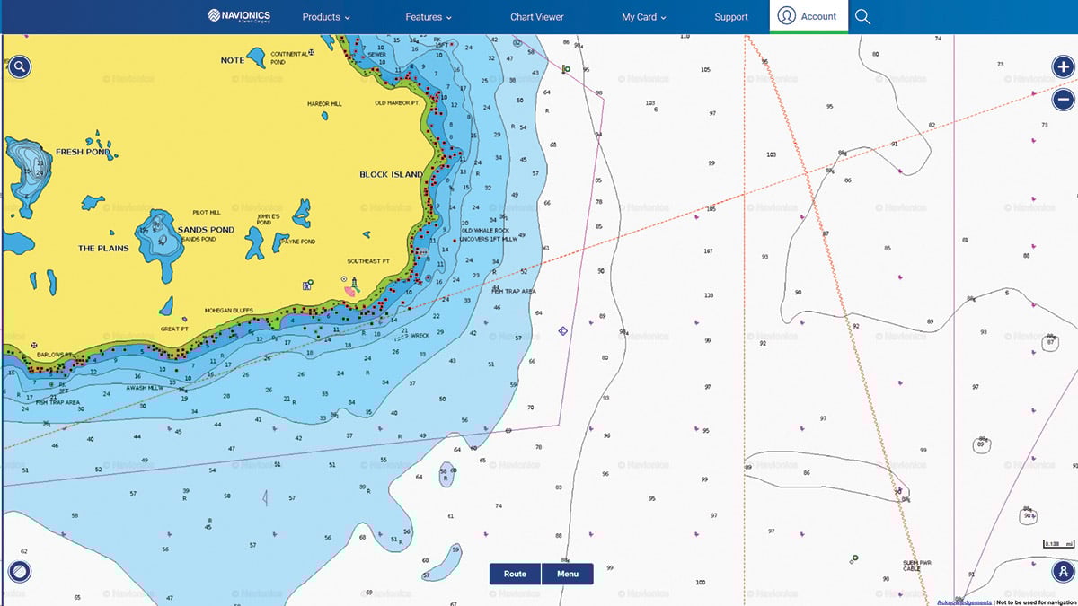
Continuing our tour of Block Island’s fishy structure, the Southeast corner of the island offers great variety throughout the seasons.
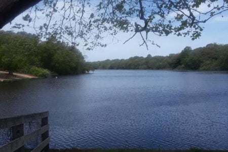
The southeast corner of Block Island, set under the backdrop of the picturesque Southeast Lighthouse, is as diverse as it is a productive location to fish. The Mohegan Bluffs along the backside provide great scenery while the bottom features and location attract a variety of fish species. Cod, striped bass, bluefish, black sea bass and fluke can all be found here in catchable numbers at some point during the season. For those wanting to get somewhat away from the weekend bass crowds at Southwest Ledge, Southeast Light is only a short distance away and at times can be just as good. Eldridge Tide and Pilot book shows the flood tides running to the west and the ebb tides to the east-southeast.
If you’re looking for stripers or blues, look around 41-08-49.8/71-32-58.4 and to the southwest towards 41-08-42.5/71-33-21.8. Water depths will range from 26 to 33 feet deep, and trolling with parachute jigs or umbrellas can be effective method while searching the fish out. I prefer the flood tide for this action.
If tossing plugs into the rocky shore is your game then be sure to check out Lighthouse Cove or Cat Rock Cove up to the northeast. This area can be very treacherous with rocks so be careful and definitely scout it out before fishing it in the dark. Some big bass have come out of here, including the late Tim Coleman’s 60-plus from the surf. I’ve also had good success with the bass while trolling around 41-09-34.0/71-32-06.9, but make sure to keep an eye out for the lobster gear that’s usually in the area.
For bottom fishermen, Southeast Light also has a lot to offer. While the spring cod and pollock fishery is not what it used to be, you might be able to still pick a few cod from here, especially late in the season or very early in the spring. Look around 41-08-01.0/71-32-44.2 or 41-07-42.9/71-33-48.0 with either clams or jigs. There’s also a nice lump at 41-07-50.1/71-32-28.8 that has produced many fish for us in the past.

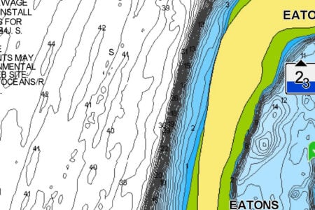
The “Pinnacle” is located at 41-07-25.8/71-33-52.8 and is a popular spot to look. Its well-defined rocky structure that sticks up is a fish magnet. Always worth a check no matter what season it is.
Black sea bass can be found on many of the humps and bumps along the southeast corner of the island. Keep an eye on your machine as you move through the area and you’re bound to find them or check out some of the cod numbers during warmer months.
If looking for fluke, try around 41-08-04.5/71-34-12.6. If you fail to find any fish there, begin working your way west along the backside of the island and you’re likely to locate a few at some point. Dogfish can become a nuisance here at times, and when they arrive in the area they arrive in full-blown packs. It’s tough fishing when they’re there as it becomes very difficult to keep a bait in the water. There’s sometimes some good fluking working back towards Old Harbor as well.
Southeast Light offers many different opportunities for fishing and has historically given up some large fish. Don’t overlook it if the weekend crowd at Southwest Ledge grows too large or the Ledge fails to produce for you.
| SOUTHEAST LIGHT – SOME NUMBERS | |
| GPS | |
|
STRIPED BASS |
41-08-49.8 / 71-32-58.4 to 41-08-42.5 / 71-33-21.8 |
|
STRIPED BASS – NE |
41-09-34.0 / 71-32-06.9 |
|
“PINNACLE” |
41-07-25.8 / 71-33-52.8 |
|
CODFISH |
41-08-01.0 / 71-32-44.2 |
|
FLUKE |
41-08-04.5 / 71-34-12.6 |
|
LUMP – CODFISH |
41-07-50.1 / 71-32-28.8 |
|
HUMP – POLLOCK |
41-07-50.1 / 71-32-28.8 |
|
CODFISH |
41-07-42.9 / 71-33-48.0 |