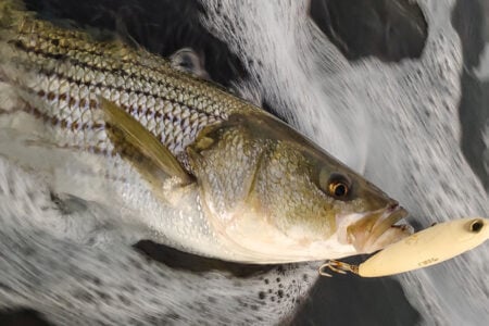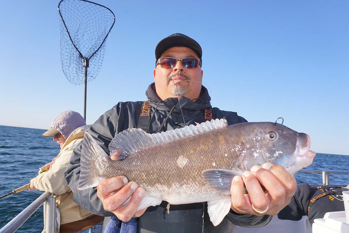
Uncovering history while researching new hot spots.
A bitter cold wind was blowing one snowy night on the Baltic Sea during the late 1930s. Rudi Plappert, an officer trainee aboard the square rigger Horst Wessel, overslept the midnight start of his graveyard watch. Found swinging in his hammock, the bosun rolled him out onto the deck, stripped him naked, and ordered – “over the top!” That meant only one thing – up one side of the foremast and down the other in a howling gale!
“No, won’t do that,” wasn’t an option in the German Navy. Rudi said he never missed the start of his watch again! True or not, his tale got my attention. I slept in those same crew quarters in a hammock and worked the fore top royal. It’s a long way up and down, even on a good day!
| NJ SHIPWRECK WEB SOURCES |
| aquaexplorers.com thebassbarn.com njmaritimemuseum.org njscuba.net njwreckdivers.com swfishing.com Eastern Se4asrch and Survey Facebook page |
Rudi spun his story in the owner’s suite living room at the Dolphin Motel in Strathmere, NJ. It was 1965, and I was home on leave from the Coast Guard Academy. Was the rumor true? “Did you pick the motel’s beachfront location through your submarine’s periscope?” He replied, “no” explaining that it wasn’t “his” submarine. He was only the torpedo officer, and he only picked the island where he was going to build his inn after the war!
Rudi said his sub sank several ships, but none off New Jersey. Other U-boats took care of that. Maybe he was just trying to be nice about what really happened while he was off of our coast.
Shelter From The Storm
Surviving U-boat duty, Rudi Plappert immigrated to America and built his inn behind beachfront dunes at Whale Beach in 1959. I was familiar with the location, having seen a whale stranded on that beach at the northern end of Ludlam Island in the early 1950s. Then came the great Ash Wednesday storm of 1962 which attacked the Atlantic Coast and torpedoed Rudi’s motel!
| NJ U-BOAT WRECKS | ||
| VESSEL | LAT | LONG |
| Arundo | 40.17361N | 73.68250W |
| Tolten | 39.896782N | 73.802902W |
| Gulf Trade (stern) | 39.82888N | 73.83277W |
| P. Resor 39.79583N | 73.43055W | |
| Bidevind | 39.808445N | 72.816208W |
| Persephone (stern) | 39.78827N | 74.07254W |
| Chaparra | 39.73138N | 73.98861W |
| Gulf Trade (bow) | 39.729008N | 74.022629W |
| San Saba | 39.69916N | 73.95222W |
| Jacob Haskell | 39.600117N | 73.024544W |
| Lemuel Burrows | 39.30667N | 74.2675W |
| Varanger | 39.00833N | 74.08333W |
| USS Jacob Jones | 38.61666N | 74.53333W |
Although less concentrated and intense than Hurricane Sandy, the storm had the same extreme effects. Winds of 50 to 60 knots blew unimpeded over a thousand-mile ocean fetch pushing waves to maximum heights. The sea surged over our barrier island during three sequential tidal cycles, rising a good 9 feet over the back-bay meadows. Our road to the mainland washed out, exposing the original cedar log corduroy road. In a scene repeated up and down the coast, hundreds of beachfront structures in coastal communities became debris fields.
Scoured beach sand carried into town by the surge buried some streets 3 to 4 feet deep. Rudi’s motel was damaged but survived. It was moved across the Ocean Drive to the back bay and rebuilt where Rudi reminisced about the Horst Wessel. Today, that ship survives as the Coast Guard training barque Eagle on which I sailed as a cadet. A few days later, my home leave was up; we never met again.
U-boats were a constant threat just offshore during the early Battle of the Atlantic. And, it wasn’t the first time. U-boats took a heavy toll along the coast during the First World War as well. Many ships were attacked and sunk within sight of the coastline by gunfire, mines, and torpedoes. The second war wasn’t that long ago when I grew up in Sea Isle City, and locals still recounted stories about U-boat attacks. The town had an Italian fishing community. There was even a tale that an Italian fisherman sympathetic to the Italian side went alongside a U-boat in fog to give the crew a basket full of lobsters! Maybe so, maybe not; what is true is that an Italian submarine torpedoed a ship off the New Jersey coast!
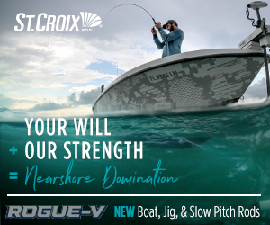
There are a lot of WWI and WWII wrecks out there, along with a host (think thousands) of other wrecks dating back to colonial times. All are unintended artificial reefs; some offer great fishing structure, even those that were demolished by explosives and wire swept to remove them as dangers to navigation. One ship sunk by a U-Boat that is well-documented by divers, the 280- by 43-foot freighter Tolten, is located about where shown by Chart 1 east of Seaside Park. The wreck site is on the eastern edge of the outbound Ambrose Channel traffic lane some 15 miles northeast of Barnegat Inlet. Look for an underwater video, pictures, and sinking history on diver websites including njscuba.net and aquaexplorers.com.
Research & Resources
Want to find a coastal wreck? A wealth of information is available for getting beyond those nondescript charted wreck symbols. A good place to start is the Coast Survey’s Automated Wreck and Obstruction Information System (AWOIS). Although no longer updated, AWOIS documents many wrecks, has a nautical chart layer, and for some structures, contains detailed results from field reports. The latter are derived from National Ocean Survey (NOS) Descriptive Reports of hydrographic survey results.
| COVERAGE CHARTS |
| Bathymetric Data Viewer side-scan sonar-like “BAG” Color Shaded Relief Coverage of New Jersey Artificial Reefs: Sandy Hook Reef (full coverage) Sea Girt Reef (full coverage) Manasquan Inlet Reef (pre-placement full coverage only) Axel Carlson Reef (full coverage) Cape May Reef (partial coverage) |
The New Jersey Maritime Museum’s Shipwreck Database, another Internet-accessible resource, has over 4,500 records. Also check recreational diver and wreck research websites for geographic coordinates, descriptions, histories, historical pictures, and underwater photographs and videos. Gary Gentile’s Popular Dive Series includes three books for New Jersey waters with detailed information about many of the wrecks (used copies are available). Some positions were based on Loran readings (Geographic coordinates are available for some of the wrecks on some of the websites in the table titled NJ Shipwreck Web Sources).
Side-scan-like multibeam sonar image coverage using the National Oceanographic and Atmospheric Administration’s (NOAA) Bathymetric Data Viewer (BDV) is incomplete. Scans for portions of the Delaware Bay and New York Harbor entrances and waters off the New Jersey north coast are available, as is a narrow band of partial coverage along the coast from Hereford Inlet to the middle of Beach Haven. (Coverage for some of the New Jersey artificial reefs is available for those sites listed in the table titled Coverage Charts).
Some wrecks and artificial reef placements occurred after images were collected. Many vessels sunk in fish havens are constructed from steel, and are generally in much better condition than older wooden wrecks. A very large number are in close proximity to each other, increasing fishing opportunities. For recent high-definition sonar scans of many offshore wrecks, check the Eastern Search & Survey Facebook page.
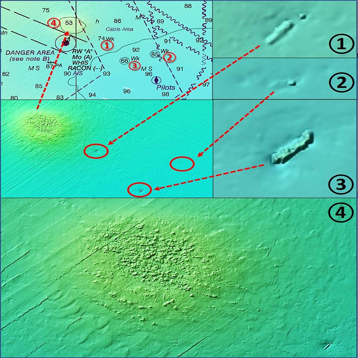
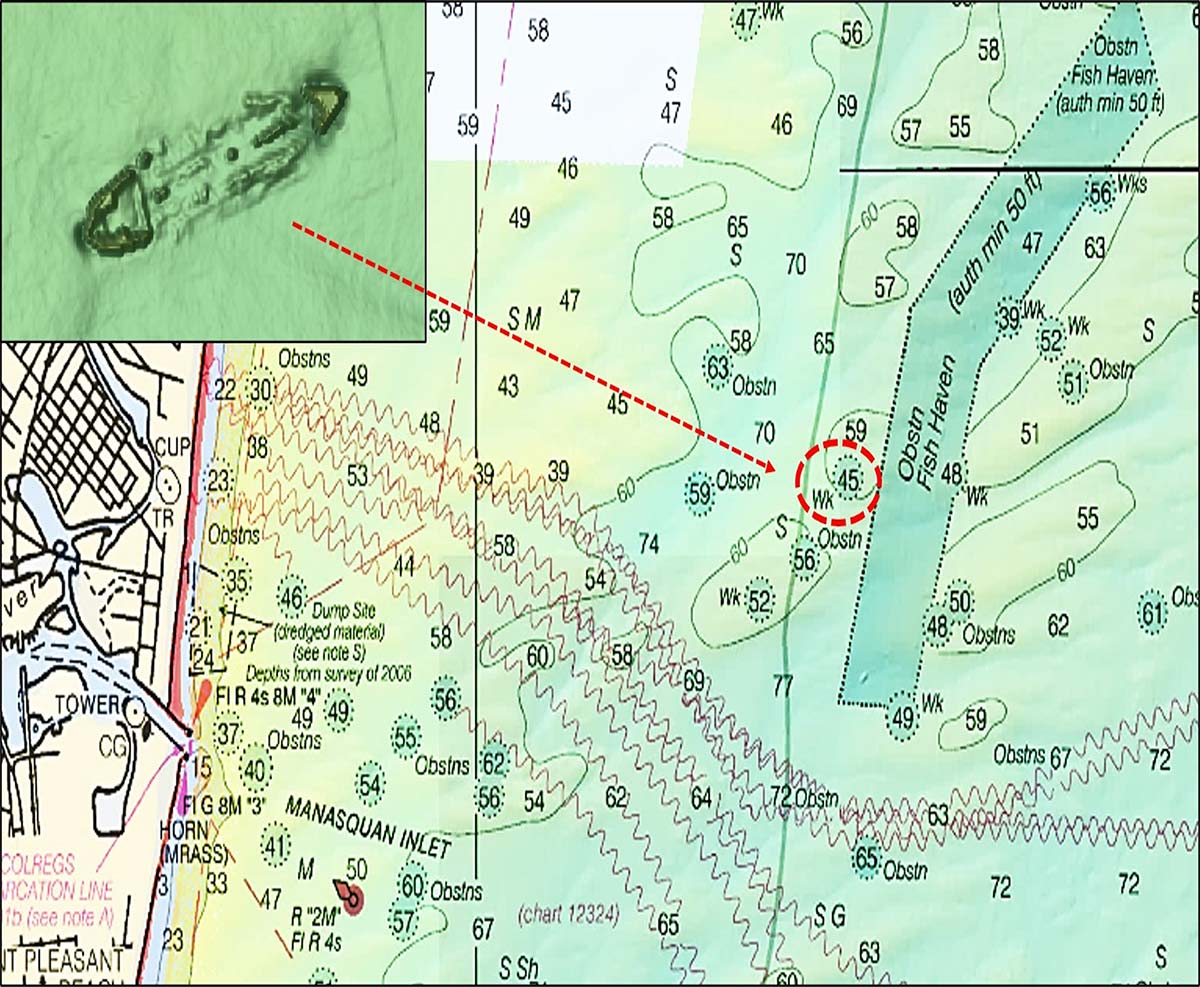
BDV “BAG” Color Shaded Relief images provide good detail for wrecks in depths under about 50 feet. For deeper depths, wreck images are pixelated, too grainy for detail, although orientation and relationship to surrounding bottom conditions can be discerned. See this effect for wrecks shown by Chart 2 just outside the entrance to Ambrose Channel. Then compare these with an image for a shallower wreck, such as the wreck just east of the Sea Girt Reef shown in Chart 3. There’s enough left of this wreck to draw the attention of reef dwellers, especially at the remains of the bow and stern. BDV side-scan images for wrecks in near-shore artificial reefs show similar detail. Also note the rough bottom mound just to the north of Ambrose channel. Spots like these are worth a look when prospecting for sport fish, especially when they can be checked while heading out to other sites. Although the BDV has limits, the application is nevertheless an important resource that is worth consulting when armchair scouting wreck fishing locations.
Many older wooden wrecks have deteriorated greatly. BDV side-scan sonar-like images where available often provide sufficient detail to assess if enough wreckage exists to check out. However, even if there’s only a gunnel frame showing, that may be sufficient to draw species that prefer bottom structure. In fact, some broken up wrecks with little showing sometimes have a huge number of fish suspended over them.
Although there may not be enough structure at a specific location to plan a trip around, try prospecting area groupings of wrecks presented by the BDV Spotlight series – go to TheFisherman.com and type “BDV Spotlight” into the search bar to find more.
Wayne Young is a former manager of the Maryland artificial reef program for Chesapeake Bay waters. He is the author of “Chesapeake Bay Fishing Reefs: Voyages of Rediscovery” available on Amazon.com. His Facebook page is Chesapeake Bay Fishing Reefs. Charts and bathymetry images are processed screenshots from the National Oceanic and Atmospheric Administration’s Bathymetric Data Viewer which can be found at www.ncei.noaa.gov/maps/bathymetry or simply by Googling “NOAA Bathymetric Data Viewer.”