Whether you get them coming or going, the lower stretch of the Connecticut River is a great spot to intercept that first cow striped bass of the season.
Native Americans called it “Quinnehtukqut” or Long Tidal River. The term “Connecticut” is derived from anglicized versions of Algonquian for, “beside the long tidal river,” and that’s how the state and river earned their complex name. This lengthy waterway runs 410 miles south from its origin in Canada, bisects Connecticut, and dumps 10 billion gallons of freshwater into Long Island Sound daily, making it an excellent fishing estuary. The I-95 Bridge spans the river and divides the Inland Zone from the Marine Zone. Therefore, you must possess a Connecticut inland fishing license north of the Baldwin Bridge.
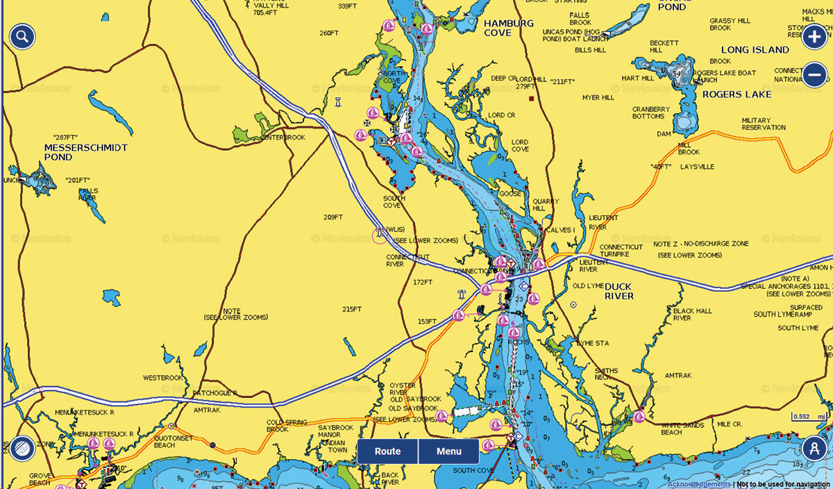
The first lower river hotspot is Hamburg Cove, which lies four miles north of the bridge’s state launch, and is one of the first locales in the Northeast to hold stripers from mid-March to mid-April before action heats up downriver. Hamburg Cove is located on the east side of the river, and is protected on three sides by hills so you’re sheltered from wind. The cove is also appealing because there are no rocks to hit, and it’s shallow enough to work light spin tackle. Access to the cove is only by boat because the land is private.
Heading downriver south of the bridge, you can find an excellent late-spring bass fishery starting at the northern confluence of the Back River, in an area called the Wood Lot. Here you can idle into a transition zone where the depth changes from 4 to 10 feet. Cast towards the shelf, and retrieve your soft plastic or surface plug across the drop-off. Drift with the current and continue fan casting until you locate a pod of stripers. The fish are usually in the shallows, but the deep side holds bass, too. From here, motor south to Gibraltar Rocks, which are three clearly defined boulder fields. This is a great spot to anchor, but be cautious of subsurface rocks. Cast up or across current and retrieve just fast enough to keep your lure from hanging bottom.
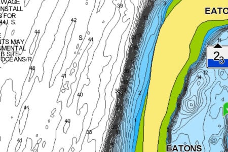
Farther seaward and just east of Buoy #10 are Sodom Rocks, which is a perennial hotspot. Continuing south from there, you’ll find another cluster of rocks and small marsh island to cast to just east of Buoy #8. Griswold Piers, just south of Buoy #8, is a fishy area denoted by three small rips. Finally, at the river mouth, you can cast to sandbars and the breakwaters, which can provide action on an ebb tide.
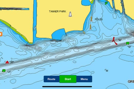
On the flood, work back upriver towards the Wood Lot. Begin fishing the Great Island shore just north of Poverty Point, this time in the shallow 3-foot water close to land. Once you’re a cast’s distance from shore you can work spots like Great Island (south of the bridge) or Calves Island (north of the bridge).
From Great Island, you could also explore the boulders marking the entrances to the Back River and to the Lieutenant River. If you’re new to this area, be cautious of these rock piles, many of which are remnants from the days of haul seining, but which attract bass, bluefish and hickory shad.
Slightly downriver on the west (Old Saybrook) side is a bridge and North Cove, which offers more structure. This waterway is good for bluefish in late summer, and a surface plug can spark action at first light or in late afternoon when slammer blues are drawn in by bunker.
For those anglers without a boat, Ferry Landing State Park is located at the DEEP Headquarters in Old Lyme, and it offers access along a fenced boardwalk/bulkhead area just north of the railroad bridge. A 1,000-foot-long fishing pier is also featured, which runs southward under the train bridge and along the shoreline. From here, cast bait or lures towards the river channel for a shot at blues, bass and fluke.