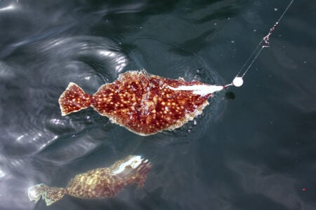
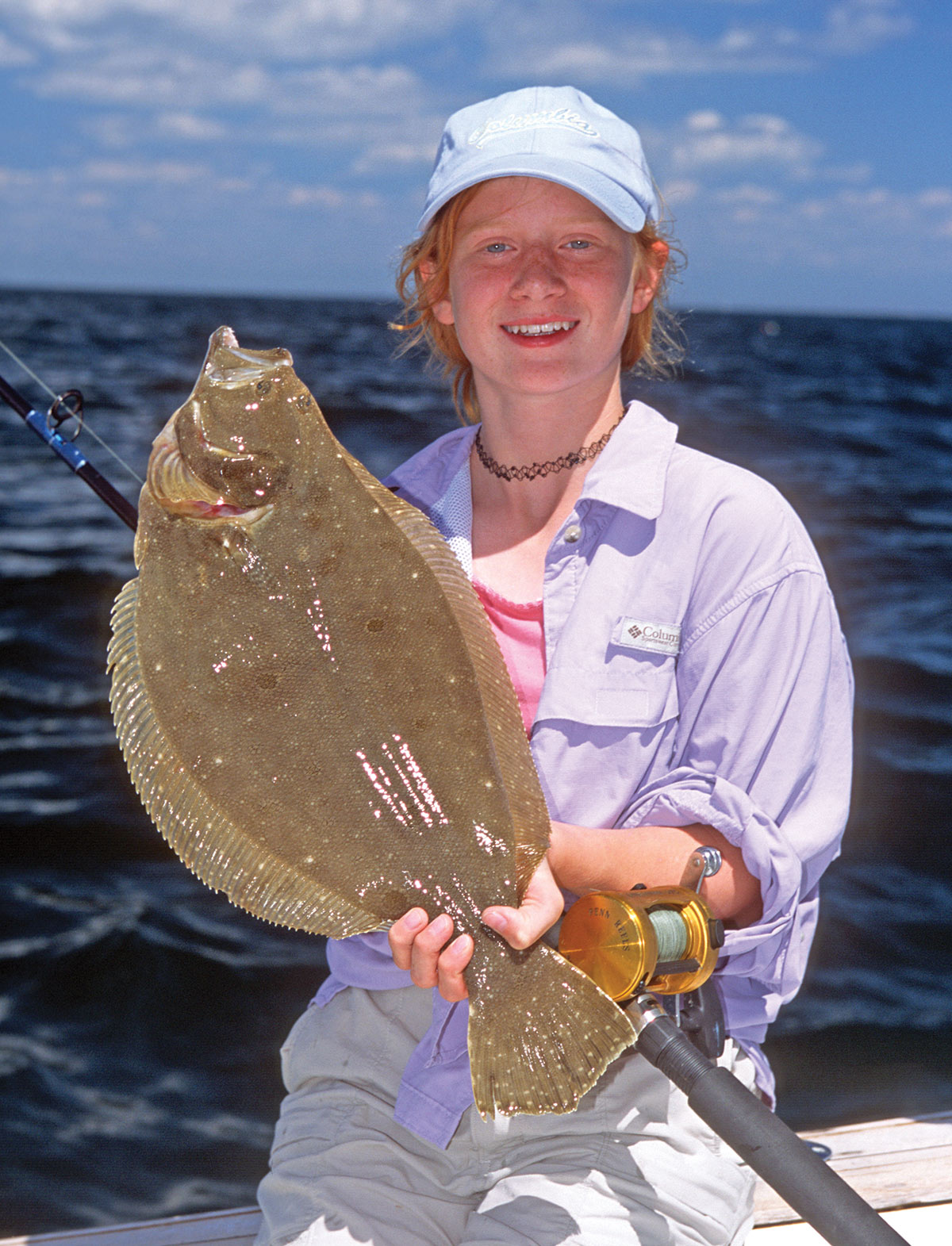
Long Island Sound is a very fishy place. Part of the reason is because it technically qualifies as both an estuary and a sound. Perhaps unlike other sounds and bays, it features tidal entrances at opposite ends, which helps to draw and disperse forage species and currents across its 113-mile length. Although its deepest point is 320 feet at the Race, the Sound averages only 63 feet deep, which is perfect for attracting and targeting fluke.
Significant rivers like the Thames, Connecticut, Quinnipiac and Housatonic—estuaries themselves—and the numerous salt marshes dotting the Connecticut and New York coasts, create bountiful habitats for drawing, producing and flushing baitfish into nearshore waters. Moving generally from east to west, here are a few proven places to look this season.
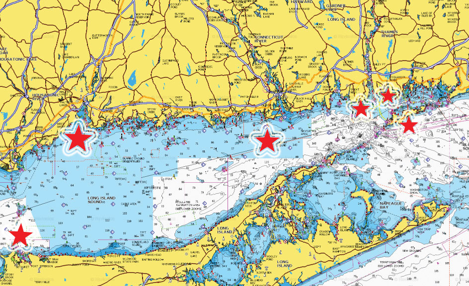
Fishers Island
Isabella Beach, typically referred to as just “Isabella” by locals, is about a half-mile long, slightly-banana-shaped stretch of sand on the south side of Fishers Island, NY. Although Isabella is technically just east of Long Island Sound proper, it’s only a short run from the eastern entrance of the Sound.
“When we report good fluke fishing ‘off Isabella,’” said Q Kresser, manager at River’s End Tackle in Old Saybrook, CT, “what we mean is anywhere along the 2-1/2-mile stretch of sandy bottom from Wilderness Point to the west, and South Reef to the east, not just off Isabella Beach itself. This whole area holds keeper fluke.”
Most success comes from shallow 40-foot depths, although keeper fluke are taken here in up to 100 feet of water. The tendency is for the fish to move deeper as the summer waters warm. One time-tested tactic, of course, is to follow the drift of the fleet. Or just make progressively deeper drifts on your own, starting in 40 feet and working your way out. Record your drifts on your GPS, which allows you to repeat productive tracks once you locate the fish.

Mike Stepski, captain of the Tartan II, a charter vessel specializing in bottom fishing out of Niantic, Connecticut spends a lot of time on the backside of Fishers Island. “The nice part about fishing there,” he said, “is it’s such a large area that when the bite ends in one spot, you can move down the island a bit or out into deeper water and achieve more drifts. Knowing when the tide starts in these different areas really helps you plan your trip effectively. Catch the beginning of the tide near a reef or slope and keep working until you find them.”
Two Tree Channel
Two Tree Channel (often labeled “Twotree Island Channel” on charts) is an unusually-deep passage for one that’s so close to shore. Located between Two Tree Island and Pleasure Beach in Waterford, the depths of over 80 feet provide ideal fluke drifts during moderate tide conditions. Here you should work the edges of the drop-offs. Challenging fishing conditions occur during the strength of the tide, so it’s import to time your trips around slower current periods, especially on a moon tide.
Black Point
Black Point reef is located off the western tip of Niantic Bay and runs almost a mile south into the Sound. The water depth drops sharply from 60 to over 100 feet where the structure ends abruptly off the southernmost tip. A perennial hotspot for keeper fluke is this 100-foot swath, which runs east/west for at least a half mile. And a bit farther west, between Black Point and Hatchett Reef, Old Lyme, is a series of rugged patches punctuated with stretches of flat bottom between them. Drifting just south of and between these structures are other fluke target areas.
Long Sand Shoal
Stretching 6 miles from its east-end bell to its west-end gong, Long Sand Shoal spans the towns of Old Saybrook and Westbrook, CT, and its midpoint rests 1-1/2 miles south of Cornfield Point. The shoal is composed of a narrow band of bottom deposits, which is a popular destination for anglers from Niantic to Clinton.
The shoal’s eastern half averages about 14 feet at the high points, while the central portion and western half average only 4 to 9 feet deep. Waters to the north side of the shoal average about 40 feet deep; however, waters to the south side plummet to 100 to 150 feet deep.
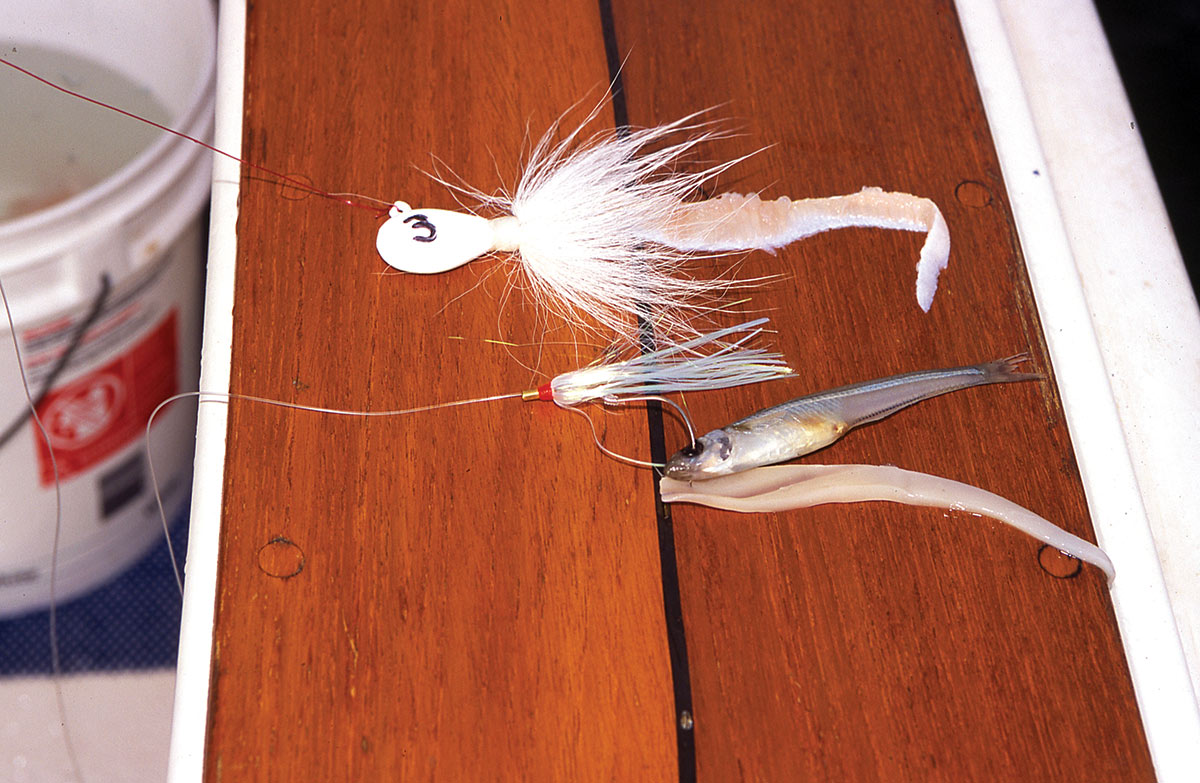
It’s on the western end of the shoal where you’ll find fluke. “They tend to be plentiful but short,” said Kresser. “If you’re looking for a spot for the kids to reel-in a bunch of fluke for catch-and-release; in other words, if your goal is quantity not quality, this is a good place to take the family for a day on the water. Even the inexperienced can often catch enough short fluke on a squid-tipped bucktail to get sore.”
But if you work the shoal early in the season before the doormats get picked over, you can have a decent shot at legal fish. You can catch fluke along the entire shoal, but the action is usually best on the western end when drifting along the slope with the diagonal current. Some days, you may never drift over the shoal but ride along parallel to it if the breeze is right, which keeps you in the sweet spot for a long time.
New Haven Harbor
The harbor is a triangular, 4-mile-long bay. Three large breakwaters define the harbor to the south and are accessible only by boat. While New Haven Harbor isn’t known for having the largest or most numerous fluke in our area, it has a lot to offer bottom bouncers in the central region. The prime fluke waters are nearshore in sheltered waters, so it can be accessed and fished by smaller boats. And it’s a short run from several launches, including West Haven, Lighthouse Point in East Haven and Branford.
Fluke inhabit different bottom types, but their prime holding areas include river mouths, sand and gravel flats, channel edges, shoals and drop-offs. Add a strong current and an estuarine environment to any of those places and you’ve got a potential fluke hotspot. New Haven Harbor is exactly such a place.
Three rivers—the Quinnipiac, Mill and West—flush forage into the area on each ebb tide. Their currents carry the length of the harbor and out into Long Island Sound. Extensive flats, weed beds and shellfish beds furnish an excellent environment for baitfish. And the long shipping channel provides slope waters for fluke to sit against and ambush food as it’s swept past.
Although New Haven Harbor is large, you can narrow the best fluke waters to three or four locations. During a moving current on either side of high tide, try the oyster stakes marking the shellfish beds off West Haven.
On an outgoing tide, especially in its last stages, work along the channel edges and slopes near mid harbor. The reason for that timing is that fluke retreat to deeper water when the shallows thin out. They move to and hold on the drop-offs where they await forage carried off the draining flats.
The third and fourth hotspots are located north of and between the breakwalls. The West Haven and Middle Wall entrance offers a good current for drift fishermen. And the shipping lane between the Middle and East Walls, particularly on the west side of the channel, is a constant producer.
Port Jefferson
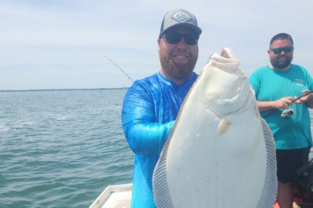
On the north shore of central Long Island is an enticing hangout for fluke. This area is a perennial producer for doormat anglers from Connecticut and New York ports.
One of the factors that may attract bigger fluke to this area is the current that sweeps in from Block Island Sound and funnels along the Long Island shoreline bringing in cooler, fresher water. Port Jeff is at the point where the Sound narrows toward the west, and the massive Middle Ground, directly north of Port Jefferson, further constricts and concentrates the current flow here.
Port Jefferson Harbor flushes into the bay on every change of the tide. The current carries the length of the harbor and out into Long Island Sound. Surrounding shallows furnish an excellent environment for fluke forage.
Three large points of land off the harbor add structure to Long Island’s otherwise straight northern shoreline. The channel, points and slopes provide holding spots for fluke to sit against and ambush food as it’s swept past. Port Jeff offers a very sudden and steep drop-off that runs from its shore toward the central Sound.
Just a short distance from Mt. Misery Point the water depth plummets from 10 to 90 feet. And off Old Field Point, the depth falls from 30 feet to well over 100 feet deep. This happens within about 1/2 mile, compared to running south from the Connecticut side, which requires about 8 miles to reach 90 feet of water.
If you can’t make the long run to Block Island, check out some of these local areas for flatties this summer. If the fluke aren’t biting, most of these spots offer good shots at keeper sea bass, too!