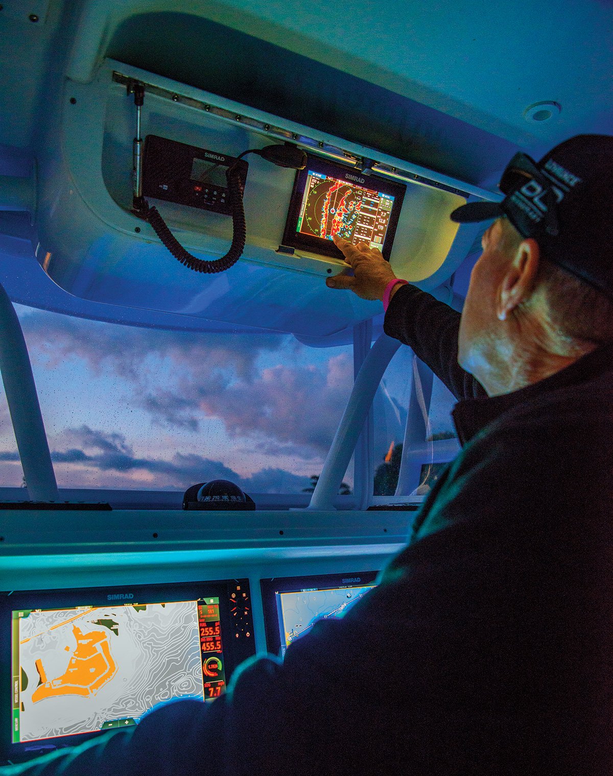
For this month’s column we are taking a closer look at the latest in marine electronics. Although I initially outfitted my 2006 EdgeWater 228CC when I bought her four years back with twin Furuno 7-inch multi-function displays (MFDs) for GPS chartplotting/fishfinding duties, the rapid generational improvements in marine electronics has given me the urge to re-outfit her. This time around, I am going with a state-of-the-art Simrad touch-screen 12-inch display with networking, wireless and Bluetooth capabilities. As many Fisherman readers have probably figured out by now, a big screen is definitely the cure for aging eyes! With fierce competition bringing both the prices down and the overall functionality up to new levels, it’s a great time to breathe fresh life into your favorite ride.
Lowrance
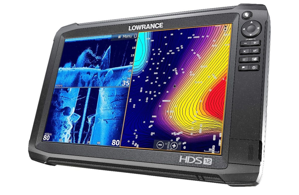
Lowrance, a world-leading brand in fishing electronics since 1957, recently announced the new HOOK2 series of fishfinders/chartplotters, delivering a new standard for ease of use and affordability. According to parent company Navico’s CEO Leif Ottosson, “With HOOK2, our goal was to capture the spirit of the Lowrance customer who values enhanced sonar and imaging, simple controls and clear displays…all at an extremely competitive price. From auto-tuning sonar settings, wide-angle sonar with double the coverage of most fishfinders and the easiest-to-use, push-button design, HOOK2 combines powerful performance and simplicity into a fishfinder that every angler will love.”
Lowrance brings improved simplicity of operation to the HOOK2 Series with a simple phone-type home menu screen. HOOK2 eliminates the hassle of fine-tuning sonar, with one auto-tuning setting to create more visible fish arches, while still maintaining clarity and target separation. HOOK2 makes it easy to find fish, with a wider sonar cone for more than twice the sonar coverage of traditional fishfinders. This expanded coverage makes it easier to see fish and track lures and bait as they fall through the water. In addition the HOOK2 series also comes with options for 2-in-1 and 3-in-1 sonar. These beefed-up sonar solutions give an accurate depiction of the underwater environment on expanded widescreen displays, including fish location, bottom structure and bait location, all with a plug and play transducer that comes in the box. It’s easy to install right out of the box with sonar included and very simple installation options. HOOK2 units feature a built in enhanced base map from C-MAP and also offer the option for upgraded mapping by C-MAP and Navionics. HOOK2 comes in five screen sizes (4, 5, 7, 9 and 12 inches) with three different sonar options and a choice of mapping/waypoint only models. The HOOK2 product line has a solution that provides you with the fishfinder you need at a price that suits you. For more information, visit www.lowrance.com.
Simrad
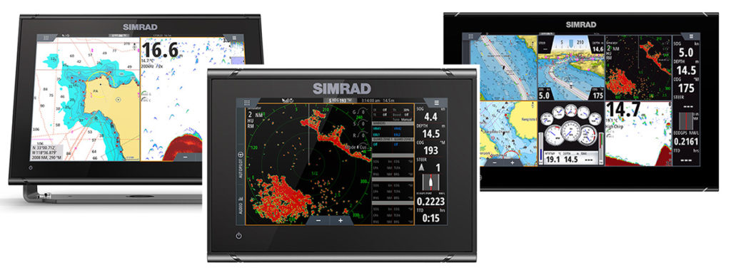 The Simrad GO12 XSE and GO7 XSR are the newest additions to the top-selling GO standalone chartplotter series. Loaded with today’s latest boating technologies, the GO12 XSE and GO7 XSR multi-touch chartplotters are the perfect fit for boaters looking for high-quality, all-in-one navigation products for fishing, cruising and watersports activities that are easy to use and offer more features at an affordable price. The GO12 XSE is equipped with a new, 12-inch display, while the upgraded GO7 XSR features a restyled, glass-helm design, along with radar compatibility not previously available on last year’s GO7 XSE.
Featuring super-bright displays and an easy-to-use interface, these new GO Series displays offer powerful functionality with intuitive multi-touch controls that smartphone and tablet users will instantly find familiar. Operators can simply tap the screen to create or select waypoints, pinch-to-zoom, or tap-and-drag to pan smoothly across charts, while simple home screen and menu layouts allow quick access to all functions. Adjustable split-screen views and customizable panel layouts with large, clearly captioned icons that are easy to recognize, make the GO Series simple-to-use, full-featured chartplotters that are intuitive, even for those with little or no experience. Fully compatible with Simrad Broadband 3G/4G and Halo Radar systems, the GO12 XSE and GO7 XSR also feature internal GPS receivers for the most accurate location, StructureScan HD and CHIRP Sonar for excellent fishfinding, autopilot integration for precision control, engine data monitoring, full audio entertainment connectivity with SonicHub2, built-in wireless connectivity and the powerful Simrad TripIntel trip computer, as well as SiriusXM weather/radio (US only). The Simrad GO12 XSE and GO7 XSR also connect to NMEA 2000 compatible sensors aboard a vessel to display engine data, fuel flow, fluid level, speed, heading and water temperature. A wide range of cartography options are available, including C-MAP, Navionics and more. I am installing one of the new GO12s on my MarCeeJay, so I’ll keep you in touch on how it works out.
Simrad has also introduced their new NSO evo3 navigation system for 2018, which is a top-shelf integrated display solution for larger cruising and sportfishing boats. The blazing-fast NSO evo3 offers a high-definition display with an easy-to-use touchscreen interface. The bright, multi-touch display features unbeatable clarity and can be viewed from any angle, even when wearing polarized sunglasses, and supports up to a six-panel, split-screen layout. The NSO evo3 will be offered in a trio of screen sizes: 16-inch, 19-inch and 24-inch displays. For more information, visit www.simrad-yachting.com.
Furuno
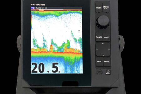
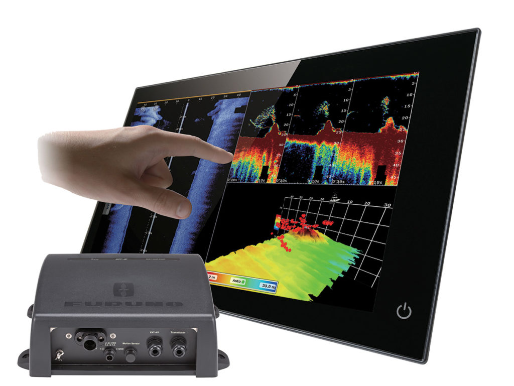 Furuno recently introduced their latest network sensor the DFF3D. This plug and play black box brings side-scanning capabilities to its NavNet TZtouch and TZtouch2 MFDs. The DFF3D utilizes a new, compact multi-beam transducer, along with Furuno’s own advanced signal processing, to produce eye-popping images that will help you find and track fish in real time. The transducer and fairing block are only 14 inches long, which makes this a perfect fit for boats of all sizes. The T/D also features a built-in motion sensor, which keeps the images stable, even in rough seas. Additional transducer styles, including a transom mount, are in the works.
The DFF3D features four display modes to choose from and allows you to customize the display with the modes you use most. Operators can choose from Cross Section, 3D Sounder History, Triple/Single Beam Sounder and Side Scan. The Cross Section mode displays a real-time sea column echo in 120 degrees port and starboard. This mode helps you to instantly determine the distribution of bait, fish and the condition of the actual water column. The 3D Sounder History mode gives you an intuitive and easy to understand 3D image of the seafloor, along with icons that depict the fish distribution. You can mark spots in the sounder history and it will create a waypoint on your chart that you can navigate back to later. The Triple/Single Beam Sounder mode allows you to display traditional sounder images on the screen, or you can display left, center and right images all simultaneously. This will show you both the depth of the fish target, plus the direction the fish are moving. All three of the beam angles and beam widths are selectable. Finally, the Side Scan mode shows you the shape of structure in a high definition image, both port and starboard. This mode is ideal for searching the seabed for any structures where fish may be hiding. The DFF3D Multi-Beam Sonar brings you the ability to see the underwater world all around your vessel in real time. Fish targets are shown in 3D within the water column, allowing you to pinpoint fishing hot spots and mark them as waypoints for later, with the depth data, so you’ll know right where to drop your line! With the triple beam sounder, you can even watch the fish swim from one side of the boat to the other. For more information on the new DFF3D, visit www.furunousa.com.
C-MAP
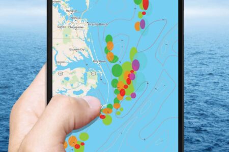
C-MAP recently announced the availability of Genesis Edge, its premium mapping service. Genesis Edge subscribers can now access new, game-changing features such as bottom-hardness and submerged-vegetation map layers, to help them catch more and bigger fish. The free version of C-MAP Genesis includes downloads of community-sourced digital Social Map charts, the ability to add personally mapped areas to Social Map and custom-color depth shading. Now, Genesis Edge subscribers can keep their own personally mapped areas private. All Genesis Edge subscribers will soon have access to tens of thousands of public Fishbrain catch locations on C-MAP Genesis charts online, giving them insight into the best locations to fish. With hundreds of catch-location waypoints overlaid on a C-MAP Genesis chart’s one-foot contours, it’s easy to identify what depths, structure and cover fish prefer and then apply that pattern to catch more fish throughout the rest of the body of water. To take advantage of the service, anglers record and upload sonar data from a compatible fishfinder/GPS unit and to C-MAP Genesis. A custom map will then be available to download for use on the water. Edge subscriptions can be purchased for $99/year or $24.99/month. Users can subscribe to the new Genesis Edge service at www.genesismaps.com.
Navionics
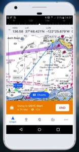 The big news for Navionics is that it was recently acquired by Garmin, back in October of 2017. According to Garmin President and CEP Cliff Pemble, “Navionics has long been known as a leading supplier of highly accurate navigational charts and mobile applications for boaters. By combining Navionics’ content with Garmin’s BlueChart and LakeVu content, we will be able to offer the best available breadth and depth of coverage to our marine customers. Going forward, we plan to retain the Navionics brand and will continue to support Navionics’ existing customers.”
Navionics founder and President Giuseppe Carnevali continued, “Since our founding, Navionics has been passionate about creating products that enhance the boating experience. Garmin shares our passion for serving the marine industry, and is an ideal company to carry the strong brand and reputation of Navionics into the future.” Big things should be coming as a result of this merger, so stay tuned for more.
SI-TEX
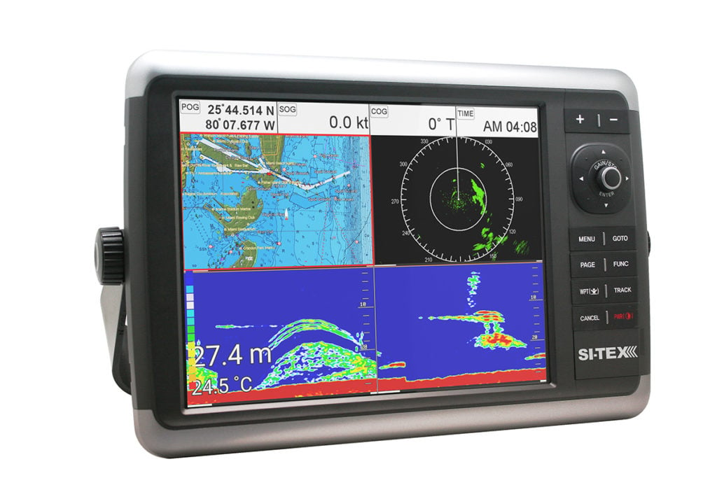 SI-TEX Marine Electronics has a trio of new product offerings for 2018. The latest of these is its new NavPro Series MFDs. Two powerful new units, the 9-inch NavPro 900 and 12-inch NavPro 1200, deliver advanced Hybrid Touch Screen control and a host of powerful features for fishermen and boaters. The NavPro Series combines powerful chartplotting and CHIRP echo sounder technology in a compact design that compliments any bridge, helm station or center console. Fully customizable display pages let operators easily access the information that is most important to them, whether they are navigating a tricky channel or trying to pinpoint a fish-laden wreck. The NavPro Series also features an advanced Remote Control App that enables wireless control using your phone, and WI-FI connectivity for easy software updates, CaptainCloud access, and more.
Also new for 2018 are the NavStar Series Multifunction Displays. Two new units, the 10-inch display NavStar 10 and the 12-inch NavStar 12, combine advanced radar, sonar, chartplotting and entertainment functions in a compact and rugged system, all with the versatility of hybrid touch-screen operation. At the heart of each of these systems is a powerful Quad Core processor for fast, seamless operation even when utilizing multiple functions simultaneously on the four-way split screen display. NavStar’s versatility is further enhanced by its built-in Bluetooth connectivity and wireless LAN, providing fast Internet connection, automatic chart and software updating, and the ability for boaters to enjoy their favorite video and music entertainment. Navigators will appreciate NavStar’s powerful 4kW dual-range radar capability that lets them view both close-in and far-away targets at the same time, for enhanced safety and situational awareness in all conditions. The built-in chartplotter provides radar/chart overlay capabilities with all the advanced navigation features and content-rich detail of trusted C-MAP 4D cartography. The third new product for 2018 is the Metadata MDA-4. This advanced VHF-FM/DSC marine radiotelephone provides mariners with professional-grade communications features and the added safety and convenience of a built-in high-performance AIS Dual Channel Receiver.
Humminbird
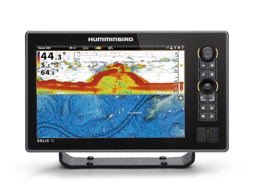 For 2018 Humminbird has expanded its new SOLIX series with the SOLIX 10. Its 10.1-inch screen makes it ideal for smaller fishing boats with downsized consoles or limited dash space. The SOLIX 10 comes in two models, with one featuring Humminbird’s exclusive MEGA Imaging with GPS and CHIRP Digital Sonar and another with GPS and CHIRP Digital Sonar only. Humminbird’s unique Cross Touch Interface allows anglers to operate the fishfinder via touchscreen or with the touchpad. Users can customize the screen with up to four independent viewing panes to simultaneously get the Down Imaging, Side Imaging and GPS mapping information they need at a glance. Individual panes can be zoomed in/out, or moved to different screen locations based on an angler’s preference or the fishing situation.
The SOLIX 10 comes standard with Humminbird’s new Basemap, which helps anglers pinpoint fishing hot spots on more than 10,000 American lakes, plus precise coverage of the entire U.S. coastline with NOAA-based charts. The Basemap also includes navigational aids, marker buoys, depths, points of interest and launch locations to improve your boating experience. Another standard SOLIX 10 feature is AUTOCHART Live, an exclusive Humminbird technology that maps and saves depth contours, bottom hardness and vegetation data on any body of water. AUTOCHART Live is also compatible with i-Pilot Link from Minn Kota for the utmost in boat control and fishing success. With the fishfinder and trolling motor communicating, an angler can direct his Minn Kota trolling motor to “follow” a specific AUTOCHART Live contour at a set speed, and with the press of a button the boat will automatically follow the exact path. The new units are also fully compatible with Humminbird LakeMaster charts, SmartStrike and Navionics Gold/HotMaps. Bluetooth is built into every SOLIX 10, allowing anglers to sync their smartphones to the fishfinder and view text messages, missed calls and signal strength right on the SOLIX display. For plug-and-fish networking, high-speed ethernet provides easy connections to Humminbird 360 Imaging, Minn Kota i-Pilot Link, Humminbird CHIRP Radar, and additional SOLIX or select HELIX units.
Garmin
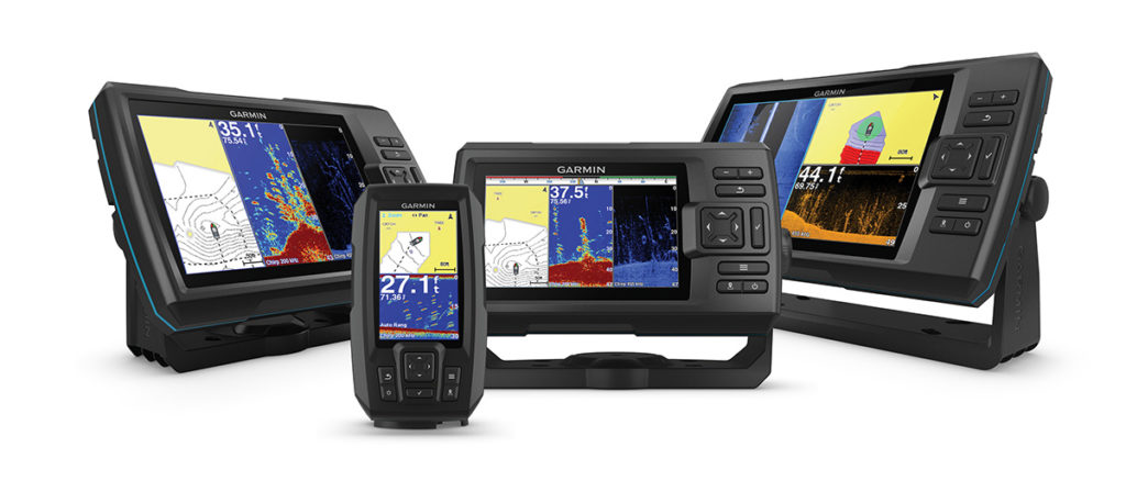 Like the first-gen STRIKER series, Garmin’s new STRIKER Plus models offer built-in CHIRP traditional sonar and CHIRP ClearVu and SideVu scanning sonar technology. In addition to generating crystal clear fish arches and excellent target separation with CHIRP sonar, Garmin ClearVu shows a nearly photographic wide image of what passes below the boat, while SideVu gives anglers a crisp, clear view of what lies off to each side of the boat, including structure, submerged objects and fish. STRIKER Plus users can create HD fishing maps of the places they’ve been. Thanks to the built-in Quickdraw Contours mapping software, it’s easy to create and store up to two million acres of maps with 1-foot contours. With the addition of built-in Wi-Fi, users can take advantage of the free all-in-one Garmin ActiveCaptain mobile app that creates a simple yet powerful connection between a compatible mobile device and a STRIKER Plus unit. Thanks to ActiveCaptain, waypoints and routes can be transferred directly to a STRIKER Plus unit making it easier than ever for anglers to pre-fish a body of water. The Plus series comes standard with a built-in high-sensitivity GPS receiver, so fishermen have the ability to not only see fish and structure below the boat, but also to quickly and easily mark favorite fishing spots and other structure and get back to them. Users can also share waypoint data across multiple STRIKER Plus units, as well as the new ECHOMAP Plus series devices. All Plus series units feature bright, sunlight-readable color displays. With a rugged design and keyed interface that’s built to withstand the harsh marine environment, the STRIKER Plus series comes with everything anglers need to make getting on the water fast and easy. The six new models offer flexible mounting so the devices can be tilted for an optimum-viewing angle. An optional flush-mount kit is available for in-dash installation. Additionally, the STRIKER Plus series is compatible with a wide-range of optional Garmin scanning transducers to customize sonar performance and installation options.
Also new for 2018 are a quartet of ECHOMAP Plus series MFDs in 4-, 6-, 7- and 9-inch models. Building on the success of its predecessor series, ECHOMAP CHIRP, the new ECHOMAP Plus features powerful sonar capabilities, preloaded charts and mapping, and built-in WiFi for access to the new Garmin ActiveCaptain marine app for the ultimate connected boating experience.
Raymarine
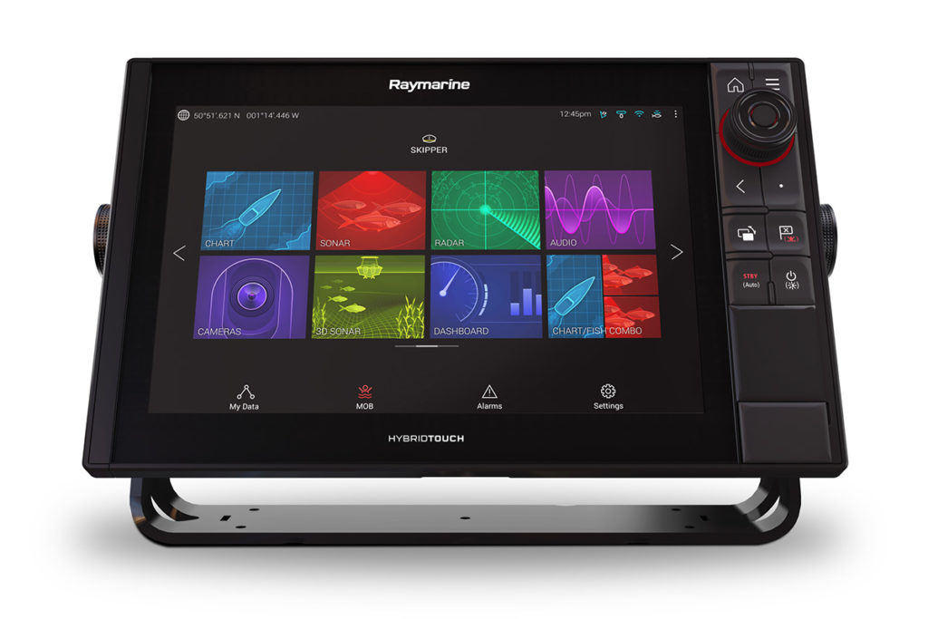 Raymarine’s award-winning Axiom range of high-performance MFDs available to offshore anglers and performance-minded cruising boaters. Axiom Pro models are designed around Raymarine’s proven HybridTouch control user experience, featuring both a multi-touch touchscreen control of the LightHouse 3 operating system along with keypad, trackpad and a rotary control interaction. The combination of tablet-like touch screen and intuitive keypad operation lets operators efficiently and confidently access all of Axiom Pro’s features in all sea conditions. Axiom Pro is also available with two different built-in sonar options. Axiom Pro RVX models have dual built-in sonars. RealVision 3D sonar offers CHIRP SideVision, DownVision, conventional CHIRP sonar and full 3D display. A 1kW high-performance CHIRP sonar for deep-water fishing is also built-in. Axiom Pro models are powered by Raymarine’s all-new LightHouse 3 operating system. Intuitive design and lightning-fast quadcore processing makes Axiom and Axiom Pro MFDs the fastest, smoothest and easiest to use MFDs on the market today.
ICOM
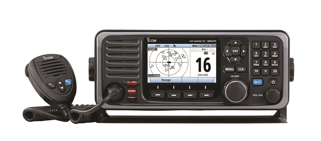 The new M605 is not just a marine VHF radio, it’s a system that allows the user choices on how to set up the radio with up to three stations. The M605 gives the user flexibility in setting up their radio system on their boat. Operators can remotely control up to three controllers using all the M605 functions with the HM-195 series COMMANDMIC and/or the RC-M600 Command Head. Either option can be used as an intercom between the radio and the unit. The M605’s large 4.3-inch color TFT LCD display provides nearly a 180-degree viewing angle. The high resolution characters and function icons combine with the directional keypad and soft keys to provide an intuitive user interface. The night mode screen provides comfortable operation in the dark. Most used functions are assigned to soft keys (at the bottom of the display) for quick one push function access. The large 10-key pad enables users to smoothly enter channel numbers, MMSI numbers with ID names and much more.
Using NMEA 2000 connectivity, the M605 radio can exchange GNSS, AIS reports, DSC call information data, radio frequency, and PGN list data on the network. NMEA 0183/-HS GNSS position data can also be converted to NMEA 2000™ data for other equipment. Adding the optional integrated AIS receiver can show AIS vessel traffic information on the display. The AIS combo screen enables you to monitor the AIS plotter during basic operation. The M605 also allows the user to directly call a selected AIS target from the AIS screen using an individual DSC all. Additional operating features of the ICOM M605 include active noise cancelling; last call voice recording saves the last two minutes of the last incoming call or start recording manually; an integrated GNSS receiver; Class D DSC; weather & alert channels; AquaQuake draining function; plus instant access to channel 16 and channel 09 call channel.
