Nine reefs that are sure to produce results for fall fishing.
If you are one of those anglers who need “insta-bites” (name derived by open and charter boat captains across Long Island) and catching lots of fish, then the month of October and a South Shore reef is just what the doctor ordered. Understand that congestion is normally heavy on all these ocean reefs along Long Island and northern New Jersey, which see bottom dwellers coming and going as a stopover before setting course for their winter residency. Then again there are a few species of groundfish that spend their entire winter and a portion of spring seeking refuge inside these man-made oases that are placed on flat sandy bottom that is most often barren of fish life throughout much of the year.
Homes Built To Last A Long Time
Artificial reefs are manmade structures which are “aquatically recycled” to provide habitat for fish and other aquatic organisms. They are made with a variety of hard, durable materials including rock, concrete and steel, which are selected based on their function, compatibility, stability and availability. These characteristics ensure that – once deployed – the material will provide suitable habitat for marine life that is safe, effective and will last a long time. Artificial reefs are used to create complex habitat in areas that lack intricate hard bottom structure, which is common off the shores of Long Island and is primarily a flat sand/silt bottom.
Artificial reefs enhance the environment by creating a biologically diverse area which provides food and shelter to a range of marine organisms. Over time, hard structures on the reefs are covered with algae, mussels, barnacles, sponges, anemones, hydroids, temperate corals and other types of encrusting organisms. Many fish and crustacean species including black sea bass, blackfish, porgy, fluke and many other species of fish and shellfish including lobsters and Jonah crab are attracted to reefs and the surrounding area for food and shelter. Artificial reefs have also been used by fish to spawn. As the reef matures, it resembles a natural reef and provides increased saltwater fishing and scuba diving opportunities.
9 Different Playlands
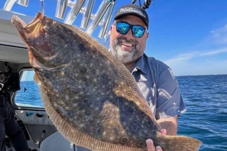
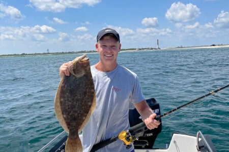
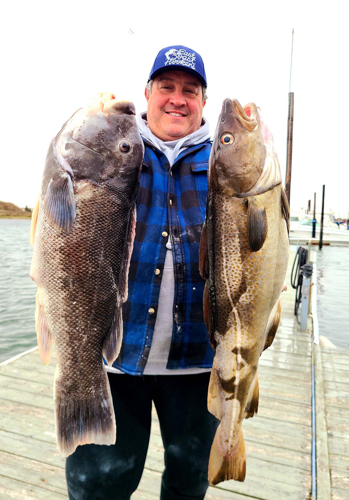
From the Rockaway to the Shinnecock Reef, nine artificial reefs are scattered anywhere from 3 to 13 miles from the nearest inlet and are sitting in depths ranging from 33 to 143 feet. From December through April the Twelve Mile and the Sixteen Fathom Reefs cough up enough cod ranging from shorts to 20 pounds to keep open and charter boats captain’s content. In addition, plenty of red hake to 7 pounds and large cunners help fill the buckets. From May through September, the remaining seven reefs produce solid fluking, excellent porgy fishing and if the poachers don’t wipe out the black sea bass population well before the season opens, then count on some pretty hefty size sea bass to go into the cooler by the start of the sea bass season starting June 23rd.
Finally, through the entire month of October and most often well into November, it becomes total mayhem at all the inshore reefs as blackfish, porgies, sea bass and triggerfish lead the pack, while frequent visits from bluefish, false albacore, bonito and Spanish and chub mackerel and the newest addition to the list, weakfish. I wouldn’t waste my time at the Twelve Mile or Sixteen Fathom Reefs during October and November as dogfish will be a big problem until the water cools enough, which will cause most of the doggies to leave and the cod and sea bass move back in again.
Getting Acquainted With The Reefs
In the following segment of this feature, let’s examine the nine artificial reefs placed strategically along the ocean floor of Long Island. As you are soon to read, each reef varies considerably in size, water depth, location, different material deployed to build these reefs, and some GPS numbers to get you smack on each of these fish cities.
Again October is most likely the most productive month of the year for wild fishing as most species use these rest areas as stop overs before migrating offshore or south for the winter. Therefore as you can be sure of death and taxes, you can be sure that all nine of these reefs will produce excellent fishing for mixed size porgies, black sea bass, and the start of some fine tog fishing. Aside from this trio being a guarantee of fast-paced action, there are several other bottom dwellers, gamesters and speedsters that will pay a visit at these reefs. Therefore let’s make a pit stop at each of these reefs and see what other visitors you can expect as each location are different and will often produce differently during the fall migration.
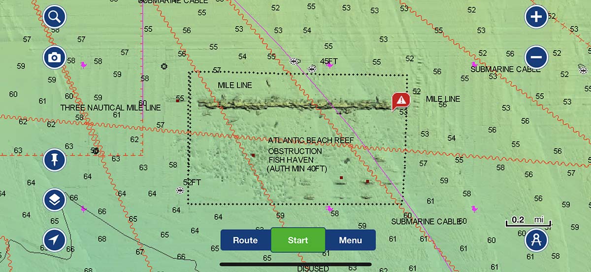
Atlantic Beach Reef
Location: Atlantic Ocean, just west of the McAllister Grounds
Size: 850 acres (3085 yards x 1335 yards)
Depth: 62 to 73 feet
Materials: 5 vessels, 13 barges, 2 boat hulls, 6 pontoons, surplus armored vehicles, 2 drydocks, Tappan Zee Bridge materials, 16 steel center beam railcars, 2 steel miter gates, 1 steel Tainted gate, steel bridge girders, steel lift bridge sections, steel pipe, steel lifting towers, rock, concrete cesspool rings, slabs, and rubble
GPS Coordinates: 40.32.020 73.43.700/ 40.32.020 73.42.400/ 40.31.530 73.43.700
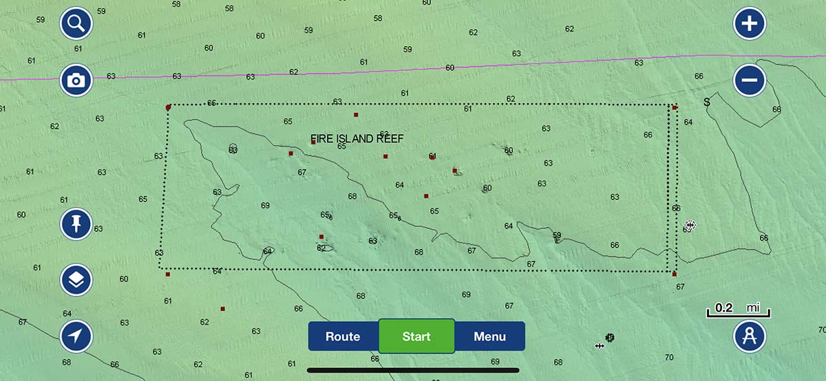
Fire Island Reef
Location: Atlantic Ocean, 2.0 nautical miles south of the Fire Island Lighthouse
Size: 850 acres (3085 yards x 1335 yards)
Depth: 62 to 73 feet. Materials: 5 vessels, 13 barges, 2 boat hulls, 6 pontoons, surplus armored vehicles, 2 dry docks, Tappan Zee Bridge materials, 16 steel center beam railcars, 2 steel miter gates, 1 steel Tanker gate, steel bridge girders, steel lift bridge sections, steel pipe, steel lifting towers, rock, concrete cesspool rings, slabs, and rubble
GPS Coordinates: 40.36.100 73.13.500/ 40.36.100 73.11.500/ 40.35.440 73.13.500
Hempstead Reef
Location: Atlantic Ocean, 3.3 nautical miles south of Jones Beach State Park
Size: 850 acres (3085 yards x 1335 yards). Depth: 50 to 72 feet
Materials: 14 vessels, 2 barges, 3 steel power plant turbines, 16 steel center beam railcars, surplus armored vehicles, 1 dry dock, Tappan Zee Bridge materials, City Island Bridge materials, Mill Basin Bridge materials, steel bridge trusses
GPS Coordinates: 40.31.250 73.33.350/ 40.31.500 73.31.370/ 40.30.553 73.33.555
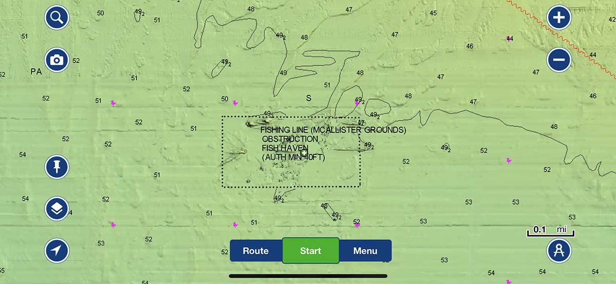
Mcallister Grounds
Location: Atlantic Ocean, 2.8 nautical miles south of Long Beach
Size: 425 acres (2036 yards x 1020 yards)
Depth: 48 to 53 feet
Materials: 4 vessels, 4 barges, 7 pieces of a 100′ scow, 2 steel miter gates, 3 steel dam gates, 1 steel power plant turbine, rock, concrete barriers, and concrete bridge rubble
GPS Coordinates: 40.32.488 73°38.892/ 40.31.985 73.38.940/ 40.32.547 73.40.209
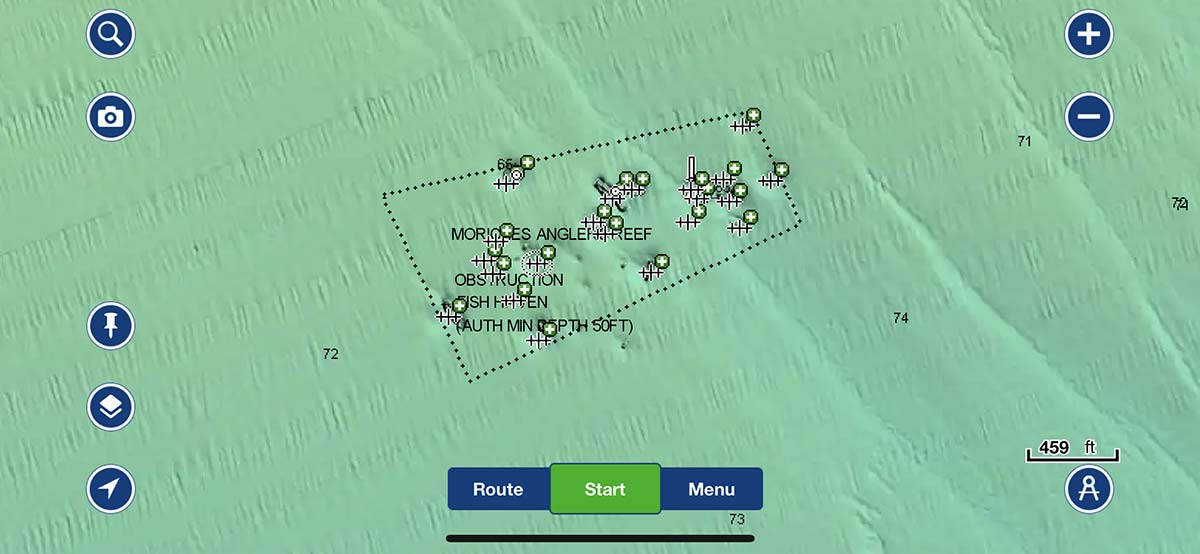
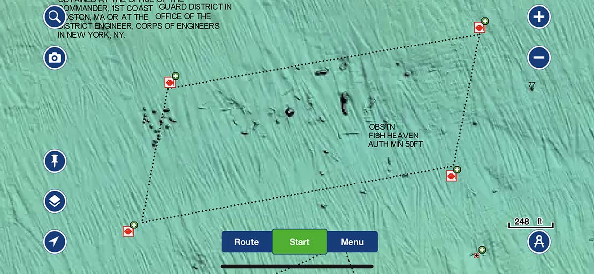
Moriches Reef
Location: Atlantic Ocean, 2.4 nautical miles south of Moriches Inlet.
Size: 850 acres (2025 yards x 2025 yards). Depth: 70 to 80 feet.
Materials: 12 vessels, 5 barges, surplus armored vehicles, Tappan Zee Bridge materials, 4 steel center beam railcars, steel floor beams, and concrete pipes. Fish pots banned by NYS law.
GPS Coordinates: 40.43.700 73.46.820/ 40.43.700 73.45.500/ 40.42.700 73.46.820
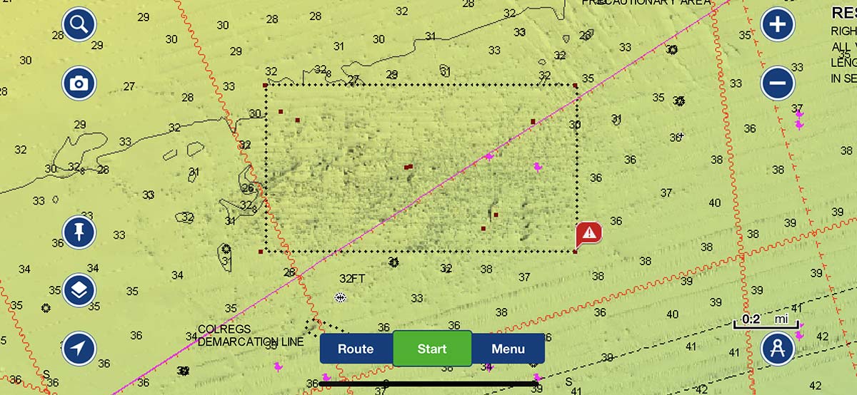
Rockaway Reef
Location: Atlantic Ocean, 1.6 nautical miles south of Rockaway Beach.
Size: 635 acres (2639 yards x 1173 yards). Depth: 32 to 40 feet.
Materials: 1 barge, 60 steel buoys, Tappan Zee Bridge materials, rock, concrete slabs, pipes, culvert, decking, and rubble. Rock rubble is scattered throughout the reef site. Fish pots banned by NYS law.
GPS Coordinates: 40.32.780 73.51.380/ 40.32.200 73.49.670/ 40.32.200 73.51.380.
Shinnecock Reef
Location: Atlantic Ocean, 2.0 nautical miles south of Shinnecock Inlet.
Size: 850 acres (2025 x 2025 yards).Depth: 76 to 84 feet.
Materials: 8 vessels, 5 barges, surplus armored vehicles, 7 steel center beam railcars, 1 dry dock, rock, Tappan Zee Bridge materials, a steel and concrete tower, steel and concrete bridge rubble, steel pipes, steel beams, and steel bridge trusses. Fish pots banned by NYS law.
GPS Coordinates: 40.48.600 72.28.930 / 40.48.600 72.27.600/ 40.47.600 72.28.930

Sixteen Fathom Reef
Location: Atlantic Ocean, 13 nautical miles southwest of Fire Island Inlet.
Size: 850 acres (2025 yards x 2025 yards).Depth: 85 to 103 feet.
Materials: Undeveloped.
GPS Coordinates: 40.26.430 73.23.255/ 40.26.430 73.20.935/ 40.25.430 73.22.255.
Twelve Mile Reef
Location: Atlantic Ocean 12.0 nautical miles from Moriches and Shinnecock Inlets.
Size: 850 acres (2025 yards x 2025 yards).
Depth: 123 to 143 feet.
Materials: 2 vessels, and 16 steel center beam railcars.
GPS Coordinates: 40.37.250 72.32.250/ 40.37.250 72.30.930/ 40.36.250 72.32.250
Well-Suited Tackle
When fishing on the reefs or any area of structure for that fact, your best results will come from rods with fast taper tips for sensitivity, and powerful butt tapers for the lift needed to haul any outsize species from these wonderlands of the sea. My favorite combo which suits the situation perfectly is the 7-foot Lamiglas TFX7030CT Tri Flex Series. The exclusive graphite/fiberglass construction of this stick gives me all the sensitivity and power I need to challenge the toughest of bottom dwellers. I match the rods perfectly with the Daiwa SL-X30SHA Sealine conventional reels with the power and speed at a 6 to 1 ratio to get the fish off the structure before they have a chance to realize they have been had. PowerPro 30-pound braid completes the combos.
Fit For The Occasion
Bottom rigs are made simple consisting of a pair of Gamakatsu 3/0 Octopus hooks connected to a dropper loop of a 40-pound fluorocarbon leader approximately 6 inches above the sinker and another dropper Loop for the second hook place 6 inches above the lower hook. This rig should hold ground and work ideally with just about any groundfish including blackfish. This style of hook is super sharp, strong and a short shank which are easy to bury crab and clam baits without the concerns of the species dropping the bait as with many other style hooks. Keep the rigs to double hooks. It’s much easier to deal with two hooks than three or four especially when hang ups are an issue. Sinkers round out the terminal end. Bring along a good assortment of bank sinkers between 4 and 12 ounces as well as plenty of extra hooks and fluorocarbon leader since surrendering some terminal tackle is inevitable among areas with sticky bottoms you may encounter at the reefs.
Whitewater Awareness
The South Shore inlets all have the same thing in common — whitewater which is sometimes downright dangerous. Always remember safety must come first. Make sure to check weather and sea condition reports before heading out to avoid being disappointed in case the breakers are not passable. Days when winds are less than 15 knots are desirable, which should provide relatively calm conditions at the breakers, particularly when the winds are from the north or northwest. Fortunately, if the weather does a flip, the run back to the inlets from any of the reefs is relatively quick and with some quick thinking, you should be able to get back inside before the swells begin to build.
So this fall the reefs will have plenty for you to catch. Please practice self-restraint and don’t be a fish hog. Catch them up but please keep in moderation so that the reefs will be rich for the next angler who decides to prowl its structure.