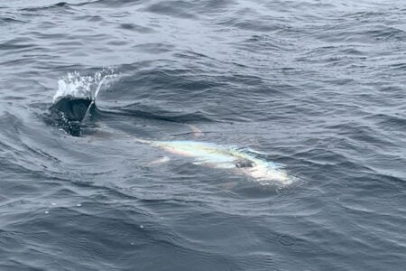
Every summer I look forward to heading out in search of bluefin and yellowfin tuna. My search area starts anywhere from 15 miles outside my home of Manasquan Inlet at the Jersey Shore out to the east about 70 miles. However making a run of 70 miles is not on the top of my list. The less miles I go the better as it will require less fuel and make for more fishing time.
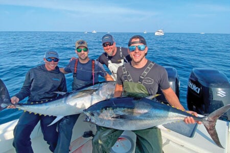
I tell my clients that I don’t want to fish, I want to catch. So the sooner I get on the fish the better. Having the correct intel can be very advantageous to do just this.
Yesterday’s Bite
Heading out to a general area that you heard there was a bite the day before is a start, but having the actual GPS numbers as to where the tuna were caught is a big bonus. For instance if the report is that yellowfin are being caught at the Triple Wrecks then good luck finding the exact spot. This is because the Triple Wrecks is just a general wide referenced area.
As mentioned by Tom Pagliaroli in his October 2020 article available at TheFisherman.com, “The Triple Wrecks is the site of a German submarine U-151 attack on June 2, 1918 that sent six vessels to the bottom of the Atlantic. These included the 332-foot steamer Texel, the 381.51-foot passenger cargo ship Carolina, the 271.2-foot twin screw freighter Winneconne, the three-masted 160.3-foot schooner Isabel S Wiley, the 226.8-foot schooner Jacob M Haskell, and the 228-foot sailing ship the Edward H Cole. The six ships are spread apart, not clustered.”
If you look on your chart you will see that the Triple Wrecks is a wide radius area. For instance the distance between the Haskell and the Cole is 31 nautical miles. So the question becomes who is willing to give you those exact numbers? You are not going to find them on the internet as a spot burn but rather you will get the info from your close knit circle of friends or dock mates. It is rare that one intel circle is going to share exact numbers with another intel circle. Good intel requires having a network of anglers that will share numbers or send numbers via a Garmin InReach while out on the grounds or by using a predesignated channel on an expansion channel VHF radio. The expansion channel will give you information in real time as often the Garmin InReach has a delay connecting to the satellite transmitting your intel data and receiving it.
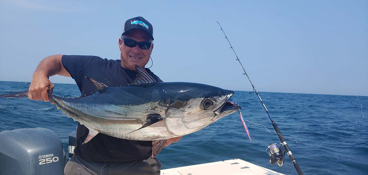
There are also paid services that you can subscribe too that that are expensive and the intel is shared only between group members and the captains that are associated with the service. They are, however, exceptionally good and usually have their members into good bites for several days before the intel becomes general knowledge. If tuna were caught in the same location for several days in a row it is a good bet they will be there the next day if nothing like presence of bait, weather, or sea conditions have changed. Without the exact location you can be a few miles away and be out of luck.
Satellite Imagery
High-tech satellite imagery can also give you intel as to where to look for tuna if you do not have any actual GPS coordinates. This imagery can be obtained by a paid subscription to a service or by searching out some of the free services on the internet. Paid services I feel are more technologically advanced in how the images are assembled and seen on your computer, easier to read, and more accurate.
Sea surface temperature and turbidity are the images that hold the most value and the ones you want to look at. When heading offshore it is advantageous to know where temperature breaks are located as these are tuna attractive locations. This is so because at these breaks there are two different water temperatures coming together with different densities. These differences in density create a physical barrier that traps plankton, the start of the food chain which will attract baitfish and then the predators.
When plankton accumulates in the water column it is also visible with satellite imagery and is referred to as turbidity or how much algae is accumulated in the water. With these shots you can easily see where the edges of blue and green water meet or where a blend of water exist. These edges again act like a wall amassing bait and will be fish producing areas. If you find an area where there is a temperature break and a turbidity break that occur on top of each other than this can be the most productive spot of all to fish.