The adventures of a lucky little fish with a big story that crossed from one side of the Atlantic to the other.
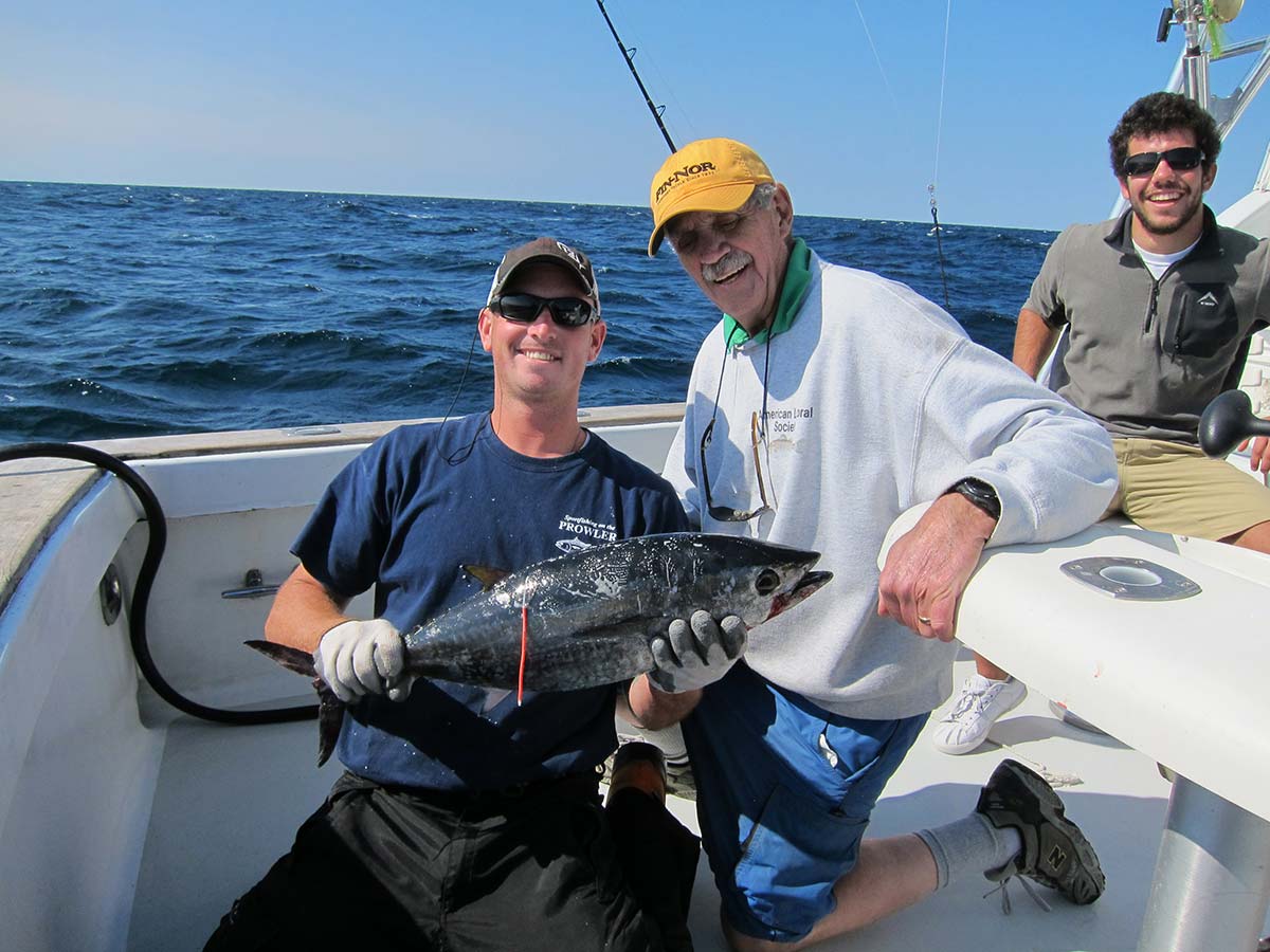
On September 27, 2004, the charter boat Prowler was tuna fishing in an area called the Mud Hole to the southeast of Block Island, Rhode Island. During the trip, one of the anglers caught a school bluefin tuna that measured 25 inches long and was estimated to weigh about 10 pounds. Captain Al Anderson placed a NOAA tag (#RF026504) into the fish and released it back into the Atlantic. That was a special day since not only was it Captain Anderson’s birthday, but it was a lucky day for that fish and the birth of a great story.
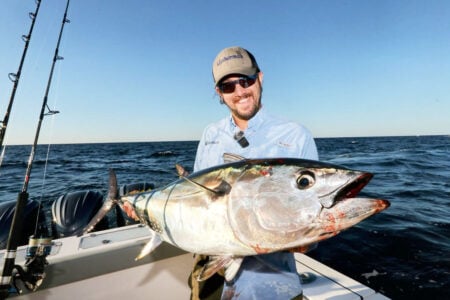
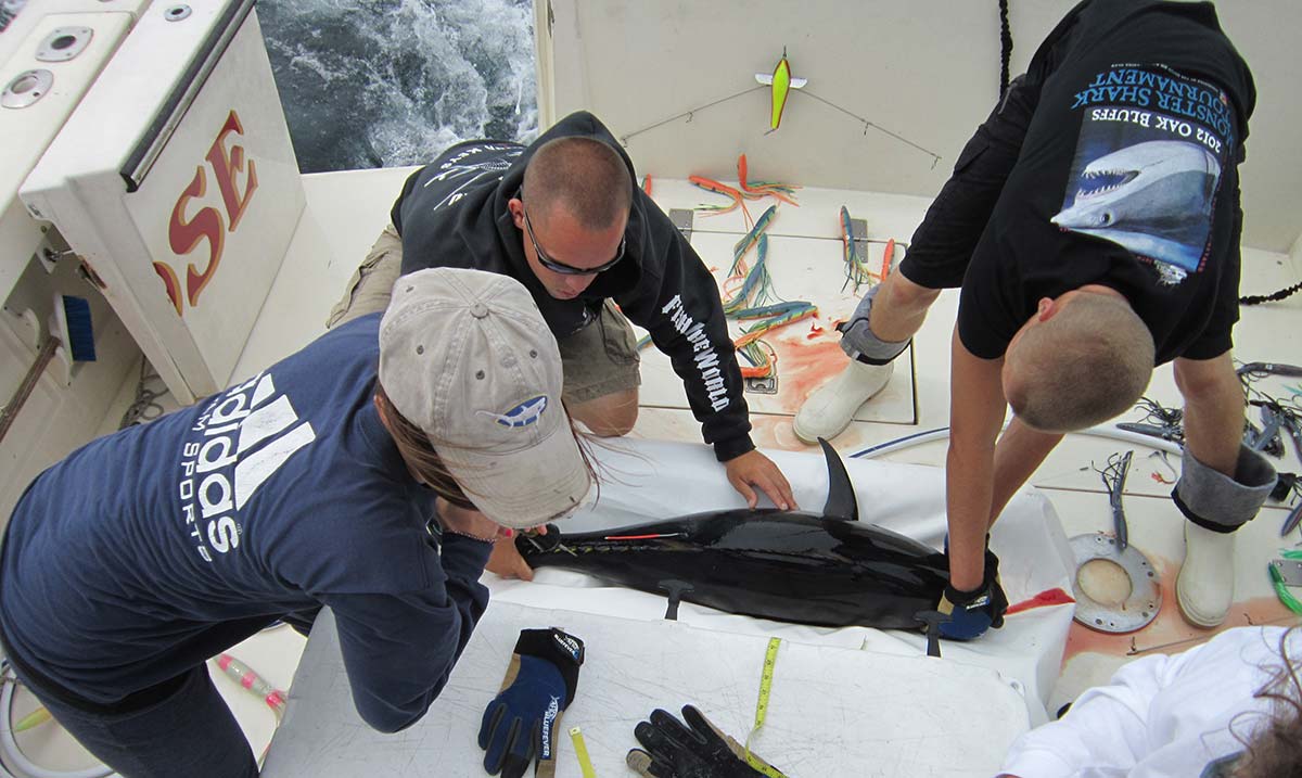
Three years later, on September 5, 2007, the Large Pelagics Research Center (LPRC) team was working aboard Captain Eric Stewart’s charter boat Tammy Rose to the south of Nantucket. They decked a small bluefin that measured in at 48 inches and was estimated to be about 70 pounds. Sticking out of the fish’s back was the aforementioned tag #RF026504, the very tag that Captain Anderson placed three years earlier.
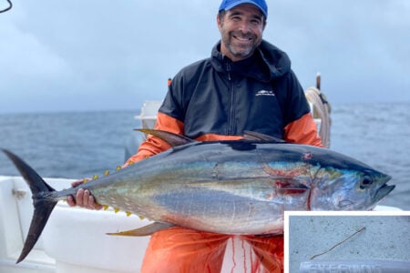
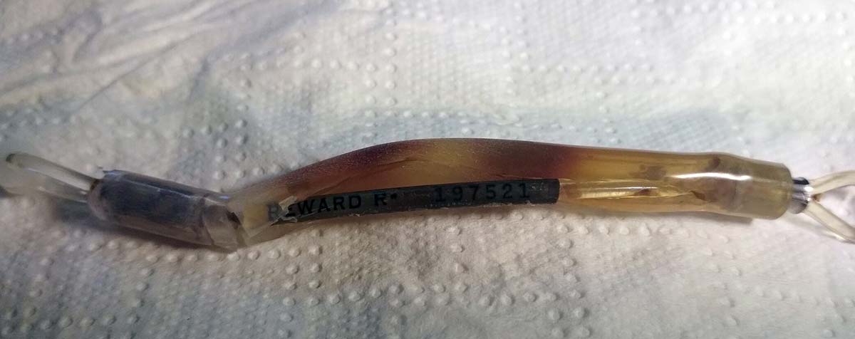
Removing Anderson’s tag, they inserted one of their more elaborate tags (#RF197521) which consisted of a tether section and a pop-off satellite (PSAT) portion. The satellite portion would pop-off in about a year and hopefully provide the many data points that it recorded along the fish’s travels during that time. The tether stays with the fish and includes a traditional tag inside. This was the fish’s second lucky day. The recapture of the fish was reported to the NOAA Southeast fisheries center so that they could compare the information to Captain Anderson’s original tag information for growth and travel studies.
Roughly a year later, as was to be expected, the pop-off tag disengaged from the fish and the LPRC was able to retrieve many data points from it. As can be seen in Chart A, the fish travelled between Gloucester, MA to the north and the offshore Georgia region to the south. The dots on the chart represent data points provided by the satellite tag. The chart shows that the fish spent a great deal of time along the Northeast Coast in the summer. While the tag information from Captain Andersons tag showed growth of 23 inches and 60 pounds, and a distance travelled between capture sites of 70 miles (Rhode Island to south of Nantucket), the LPRC PSAT tag provided information that the fish travelled the majority of the East Coast during the next year. These movements could be plotted along with the corresponding water temperatures to correlate the two. The LPRC has a great animated video of its movements along with the corresponding water temperatures that you can check out on their Facebook page. The story does not end here however.

Sometime between May and July of 2018, our sweet little bluefin friend was captured a third time. (Sorry Charlie, three strikes and you’re out!) This time it was recaptured in a set net off of Portugal, near the entrance to the Mediterranean Sea, by a commercial fishing company. The fish was penned for three months and fattened up before finally being harvested for the market. Tunipex, S.A. was the company that captured her and ended up returning the final tag information on the tether that was still on the fish. In the information they indicated that the fish was in fact a female, and it was at this point that the LPRC nicknamed her ‘Amelia’ for reference purposes, after transatlantic hero Amelia Earhart.
Amelia was essentially at liberty with the tags for 13.8 years (5034 days.) During this time she grew from 25 inches to 94 inches in length and from a meager 10 pounds to an impressive 640 pounds! The weight is probably a bit more than a typical fish of this length as it was kept in a pen, fed, and fattened up for the market during its final three months. Nonetheless, this information provided scientists vital information into the growth rate of bluefin tuna. This particular fish provided several data points, not just the initial tag and recapture locations.
The overall net travel distance indicates that the fish travelled approximately 3,400 miles. However, we know from the PSAT tag that the fish travelled the coast in the year that it held that tag so the distance travelled is much greater than that, especially when you consider it probably did that annually. Besides providing important information on the growth and migrations of bluefin, Amelia also reinforced some prior tag returns that show western Atlantic bluefin stocks do mix with those found in Europe and thus emphasizes global management is necessary and not just national.
Derke Snodgrass, a marine biologist at NOAA SE Fisheries Science Center, checked their tagging database and indicated that they have had 231 tagged bluefin cross the Atlantic to date. Of those, it indicated that 29 were fish tagged by Captain Al Anderson, including the first one known to cross. These tagging programs, which fishermen can participate in, are a means to being able to study fish in their natural habitat and are vital in helping to understand and maintain the resource. There is still lots to learn regarding these fish and tagging programs are just one means of hopefully getting some data that can be utilized. These fish have an enormous price attached to them so the more that we can learn about them, the sooner we have a better chance in helping to maintain their stocks.