Most offshore guys know about the Texas Tower; she went ghost in the last two years as the NOAA offshore buoy #44066 that marked the location went adrift on January 11, 2015, was retrieved on the following day, and then finally redeployed on November 17, 2015.
Another glitch occurred when the sensors on the buoy ceased functioning on January 23, 2016; and it went offline ever since.
On February 28, 2017, the buoy went back online. Now that you know she’s back up and running; here’s the lowdown on why you want to add the Texas Tower to your hit list beginning this month – and why it should’ve always been there!
Roughly a 66-mile run out of both Manasquan and Barnegat Inlets, the Texas Tower was originally a military warning station. Built to withstand 125 mph winds and waves up to 60 feet high, the pounding of the Atlantic battered away at the tower and weakened the foundation in the mud bottom upon which it rested. This constant battle against the elements to repair the tower earned it the nickname, “Old Shaky” and eventually a crew of 28 men remained on through the winter of 1960 to fortify the tower.
On January 15, 1961 in the wake of another monster winter storm, a distress signal was sent out as the tower began falling apart into the sea. In the pursuit to save the workers on the tower, Texas Tower #4 became blank on a Coast Guard rescue ship’s radar screen as it succumbed to the sea.
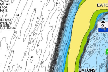
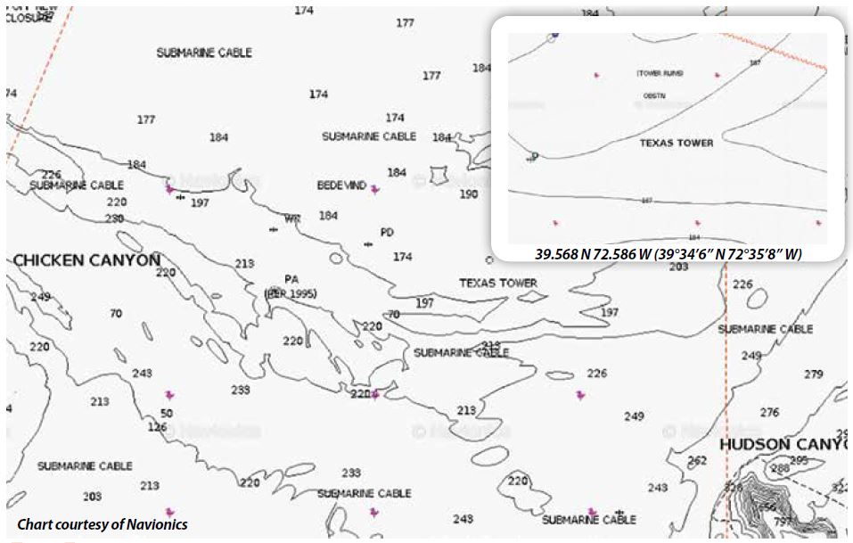
The Tower now lies in 185 feet of water, very close to the 40- and 50-fathom lines, just 12 miles northwest of the tip of the Hudson Canyon. It sits at a 45-degree angle and originally reached 60 to 70 feet up off the seafloor, but in the last decade has really started to disintegrate down to a rubble pile that still rises in most spots 30 to 40 feet off the bottom.
A potpourri of pelagics and groundfish magnetize around the tower rubble. A variety of fish stack and hold at different depths on the tower debris, with sea bass and cod claiming the bottom, pollock about 20 to 50 feet up, then tuna and sharks above them. This hierarchy of fauna creates a fully flourishing oasis in the middle of nowhere.
In April, it’s a hot cod spot as whale cod up to 40 or 50 pounds can be found milling around the structure. Huge pollock up to 35 pounds and more also patrol above the wreckage. Metal jigs dropped down score both species in April and May, though nothing really beats a fresh clam bait on a three hook dropper.
Come summer and fall, good sized yellowfin and bluefin tuna of 60 to 80 pounds can be found by trolling, jigging and chunking the area. Shark hunters targeting makos and threshers find an abundance of life around here and a well-defined chum slick will most certainly attract big time makos pushing the 300-pound mark.
A notable, and often unknown point of the surrounding area, is that four barges are jettisoned within close proximity of 600 yards from it on east, south and west sides in a U formation, providing even more fish-attracting structure.
This spot and 50 others can be found by ordering Nick Honachefsky’s book The New Jersey Boat Fisherman: Top 50 Hot Spots, available on Amazon and through most local tackle shops.