Hot Spots: The Greenlawns
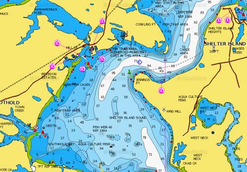
72 23’ W / 41 04’ N Located along the west side of Shelter Island between Shelter Island Sound and…
72 23’ W / 41 04’ N Located along the west side of Shelter Island between Shelter Island Sound and…
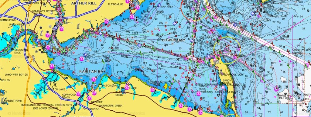
Fishing for springtime striped bass in Raritan Bay will present several different options for the boater. One can traditionally anchor…
A good spot for spring cod with the potential to pick away at a few fish throughout the season.
According to the DEC website, “Blydenburgh Lake, also known as Stump, New Mill or Weld’s Pond, is located within Blydenburgh…
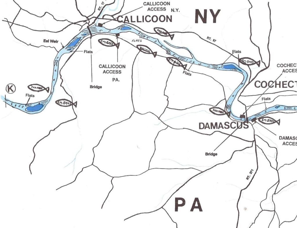
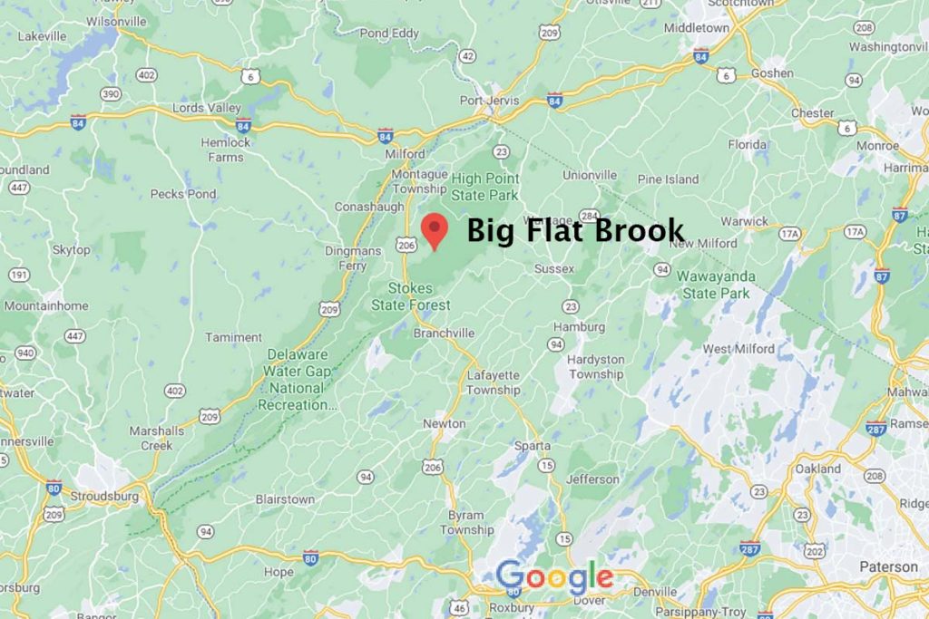
It’s time to prepare for the shad run on the Big-D!
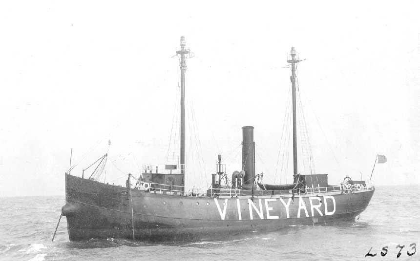
In this month’s feature articles, you undoubtedly read the article by Charley Soares on the Vineyard Sound Lightship. As always,…
It can be one of the most challenging pieces of water that wraps around the Long Island coast.
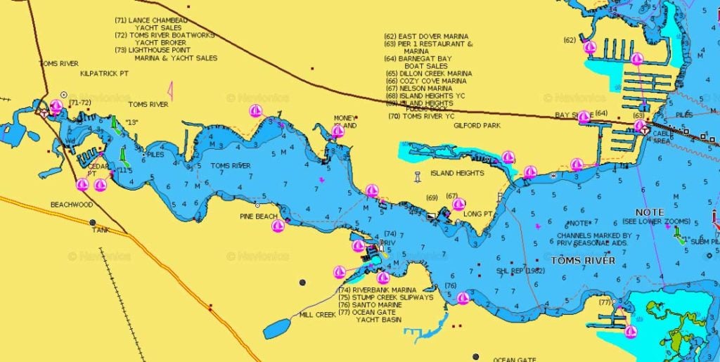
For anglers that find the long, Jersey winter dragging along, the Toms River offers the first glimmer of hope to…
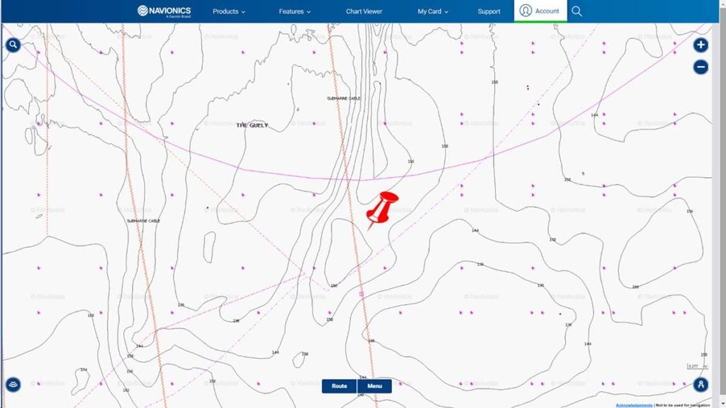
Another spot off Block Island to find some cod in the spring which also produces bonito in the summer and early fall.
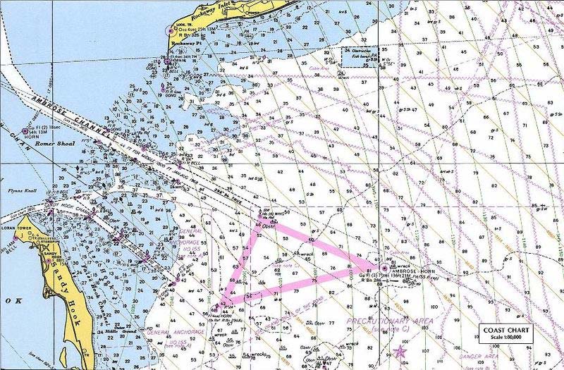
The fluke that situate themselves in Ambrose throughout the season can range from shorts to monsters of over 15 pounds.
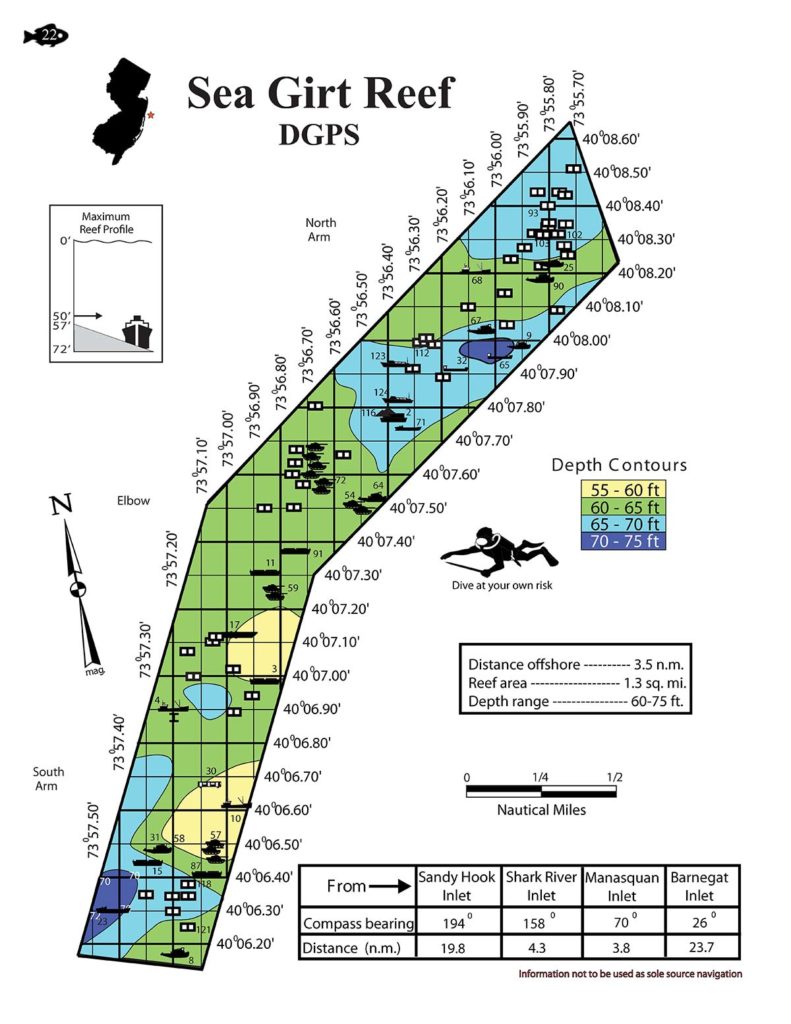
One of the finest fishing locales in New Jersey exists as the Sea Girt Reef. At a manageable 3.5 miles…
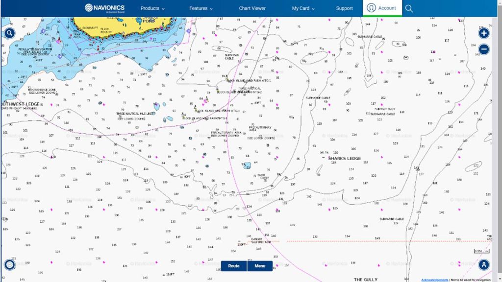
Located on the western side of Sharks Ledge, these spots produce cod year-round as well as bluefish, black sea bass and more in-season.
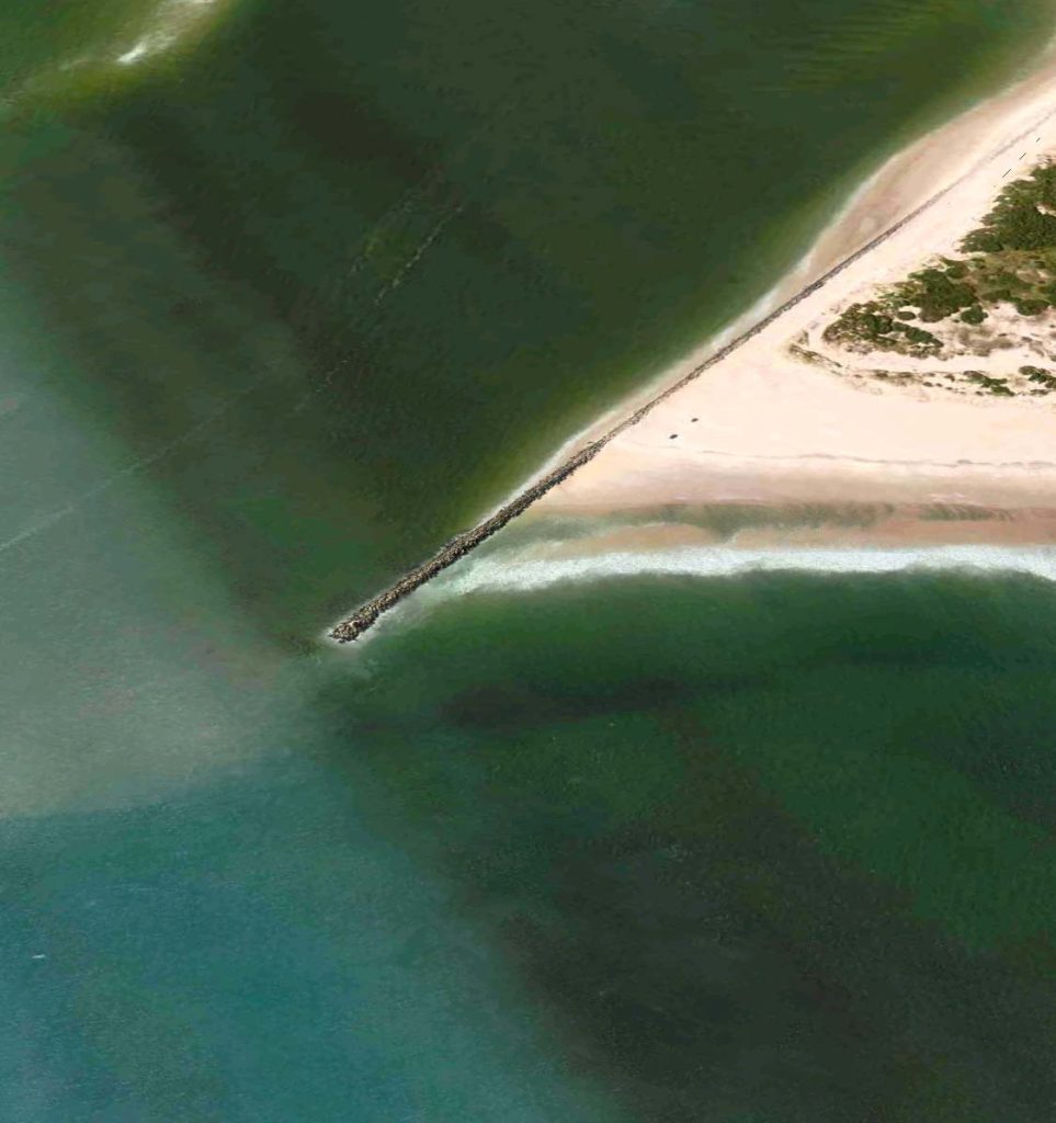
The structures of the jetty attracts a myriad of baitfish and a host of game and bottom dwelling species through the course of the season, which is beneficial to both surfcasters and boating anglers alike.
Anytime you mention winter flounder, Shark River is always one of the first spots you think of. There’s probably no…
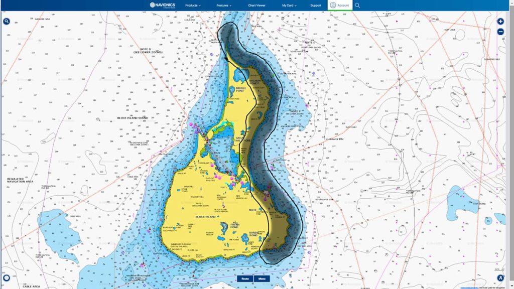
Sandy points, rocky beaches and bowls, strong-running currents and even a jetty; the east side of Block Island has it all and more.
The headwaters of New Jersey’s most beautiful trout river begin, simply enough, below the dam at Saw Mill Lake in…