
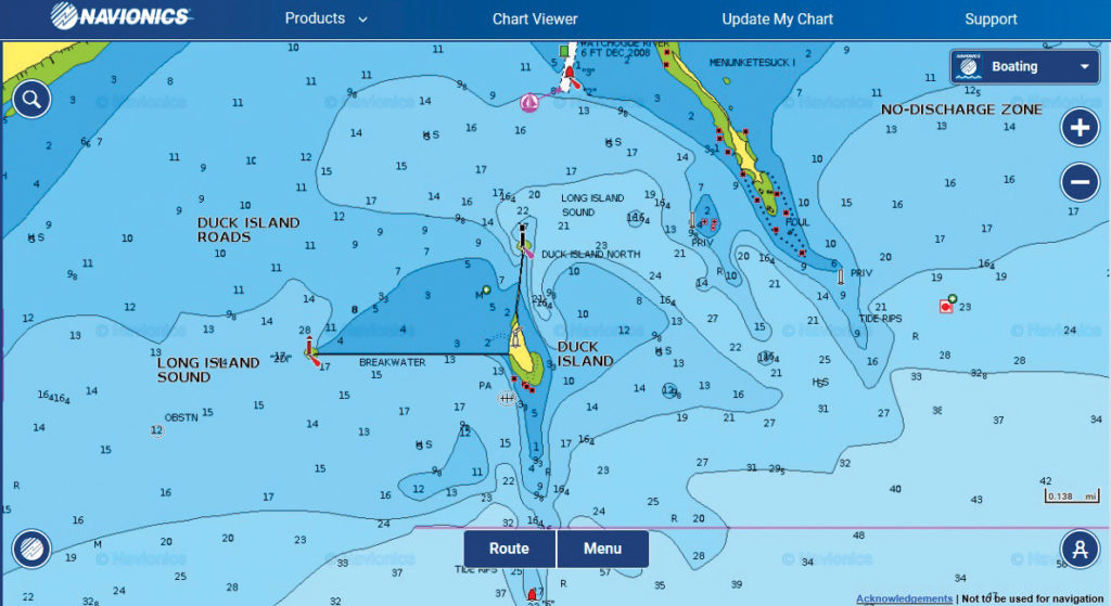
Duck Island
The Patchogue and Menunketesuck rivers flow south through Westbrook, CT, and provide a forage base for several species of sport fish in the harbor.
The Patchogue and Menunketesuck rivers flow south through Westbrook, CT, and provide a forage base for several species of sport fish in the harbor.
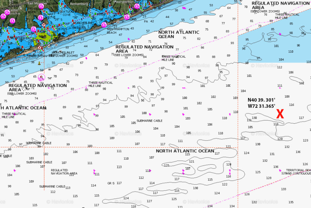
Sail approximately 13 miles southeast of Moriches Inlet to the coordinates above and you’ll be sitting smack over the Miller Wreck, which is the remains of a long ago sunken tug boat.
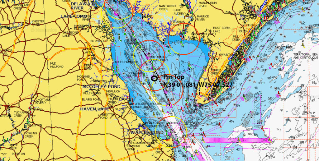
Though it’s been hit or miss the past few years, when the boom or bust black drum bite in Delaware Bay is booming, one of the main hot spots for drummin’ includes the Pin Top.
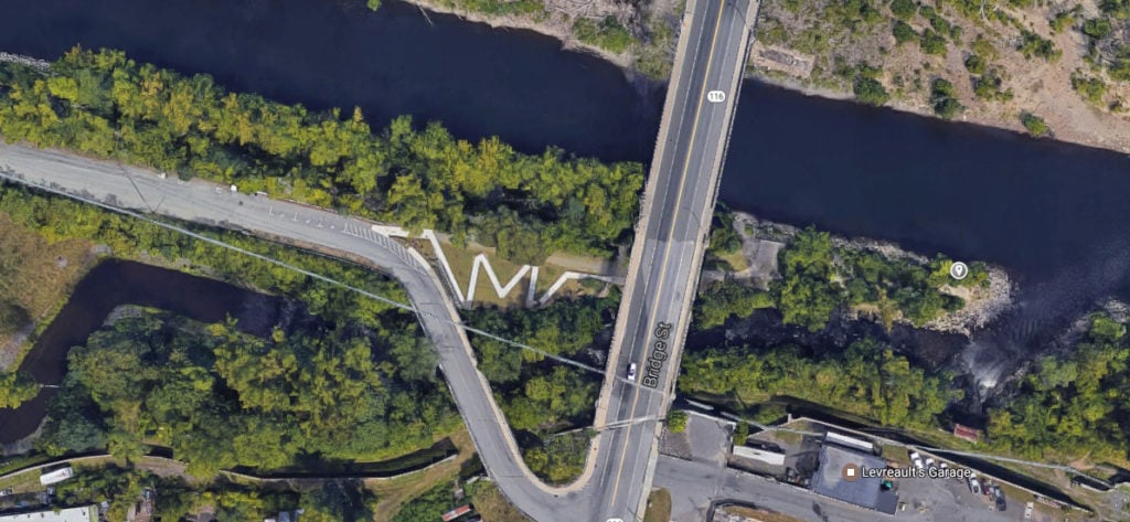
I pulled off North Bridge Street (Route 116) and found a spot to park amongst a long line of cars and trucks.
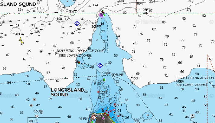
Those who fish the pristine waters of Long Island Sound’s Eaton’s Neck, which rests north of Northport Bay, should be familiar with the fishing grounds known as the Eaton’s Neck Triangle.
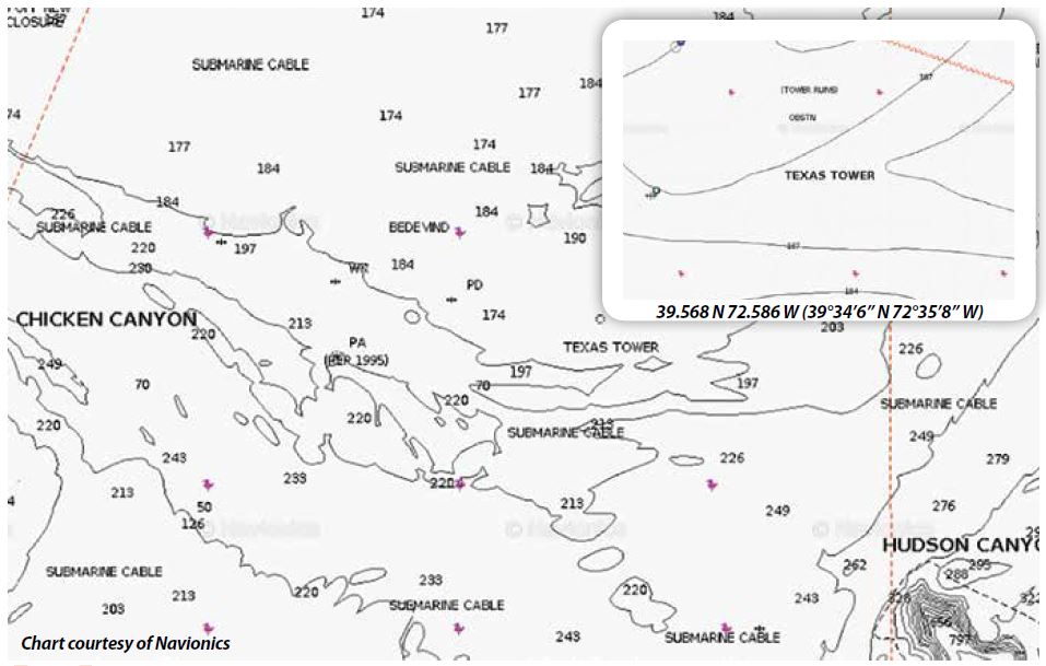
Most offshore guys know about the Texas Tower; she went ghost in the last two years as the NOAA offshore buoy #44066 that marked the location went adrift on January 11, 2015, was retrieved on the following day, and then finally redeployed on November 17, 2015.
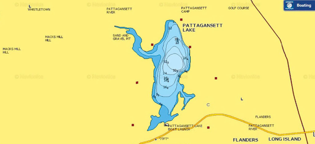
Nestled between Upper Pattagansett Road to its north, and Route 1 to its south, Pattagansett Lake is a 128-acre, lazy-S-shaped body of water in East Lyme, Connecticut.
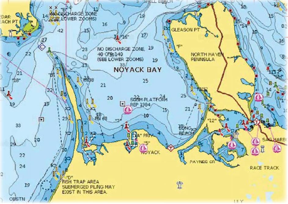
Nestled between the North Haven Peninsula and Jessup Neck and southward of the western end of Shelter Island and part of the Peconic Bay estuary sits Noyack Bay.
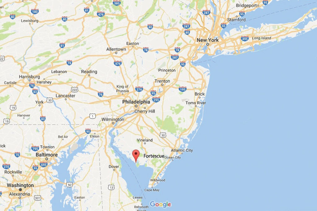
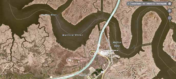
As many of Jersey’s South/Central surfcasters turn up in force at the convergence of the Mullica and Great Bay, roughly 40 miles south as the osprey flies (and arguably a bit closer to the northern migratory arrival of spring stripers) lies Fortescue Beach along the northern bayshore of Delaware Bay.
It’s fun and intriguing to imagine how the Bloody Grounds earned its crimson name. Visions of a pirate beheading, collision…
Head 2-1/2 miles southeast from the eastern tip of Plum Island and you’ll come to nun buoy 2 otherwise known a Constellation Rock.
Rolling the dice on ice is chancy for sure when contemplating hardwater ventures in South Jersey; doubly so if said swim is influenced by the lunar-driven rise and fall of the tidewaters below the Trenton-to-Point Pleasant demarcation.
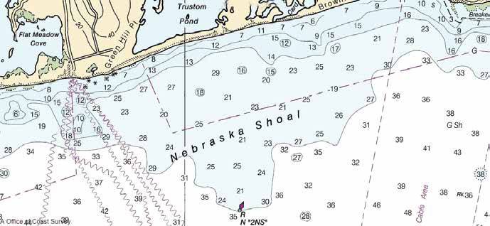
Located roughly mid-way between Point Judith and Charlestown Breachway off the south shore of Rhode Island, this expansive area and its surrounding bumps and humps are quite popular with local bottom fishermen.
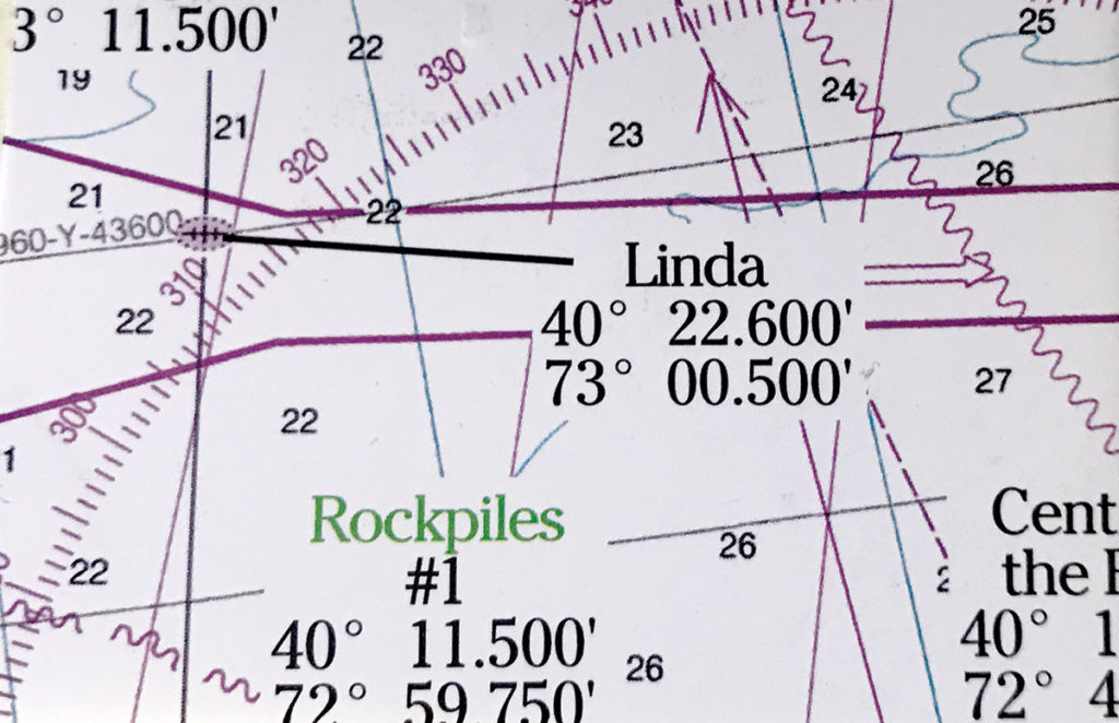
A chunk of bottom that remains a mystery lying 20 miles out of Fire Island Inlet has become known as the Linda wreck (N 40.22.524/W 073.00325) which sits on a clean piece of sandy bottom, situated upright in 135 to 140 feet of water.
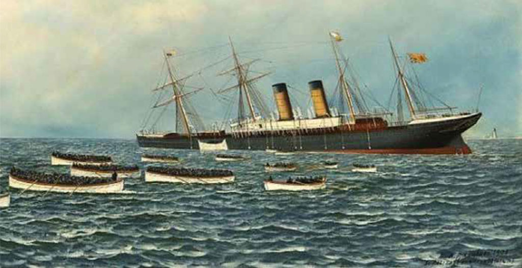
On March 14, 1886 the 500 plus foot British passenger liner the Oregon met her fate when she collided with a schooner, most likely the Charles R Morse, and sunk approximately 15 miles south of Moriches Inlet.
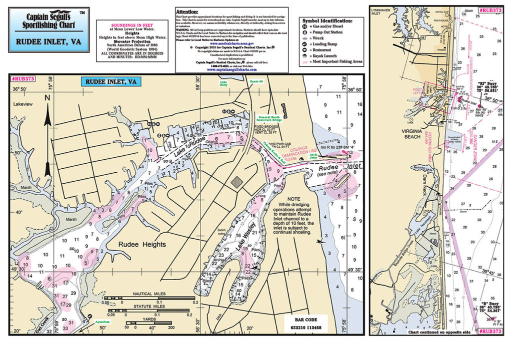
When cold weather finally drives the striped bass to their wintering grounds at the mouth of the Chesapeake Bay, Virginia Beach is definitely the place to be for folks looking to follow the migration.