Making a “milk run” could pay big dividends over the course of a fishing day.
Have you ever heard of the term milk run? The term originated during World War II when the U.S. Army Corps and RAF aircrews used it to describe any mission where enemy resistance would be minimal. Afterwards, a milk run was defined as a common practice in the dairy industry where one tanker would collect milk from various dairy farmers on a daily basis for delivery to milk processing firms.
In fishing, the milk run phrase is used primarily among freshwater tournament anglers, and relates to the strategic run they will make looking for fish in a tournament setting. However, a milk run in your everyday fishing routine could make the day more productive, and is also a way to take advantage of down time before your next trip.
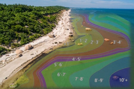
There is not a body of water I fish that I do not explore by first studying a good nautical chart of the area prior to my trip, and I will also reference it when on the boat. Whether it is a distant lake, or my own backyard waters of Moriches Bay, the chart is an integral part of my fishing. I will study these charts looking for different options at various stages of the tide and wind conditions in saltwater, and for structure, drains or fish holding areas in freshwater. When it comes to saltwater, there are no better paper charts than those produced by Capt. Segull.
The Scenario
There are a lot of times when anglers, especially when fishing the south or north shores of Long Island, will coordinate their efforts with the tides, currents and wind conditions on a given day. Think about it. If you are fishing Great South Bay and start off fishing near Oak Beach or the Robert Moses Bridge do you then work your way to the inlet? Or on the North Shore, have you ever left Stony Brook Harbor and worked your way from Cranes Neck to Mt. Misery, and then out to the Middle Grounds? Most times we just do it by memory or out of habit, but what about those areas you seldom fish?
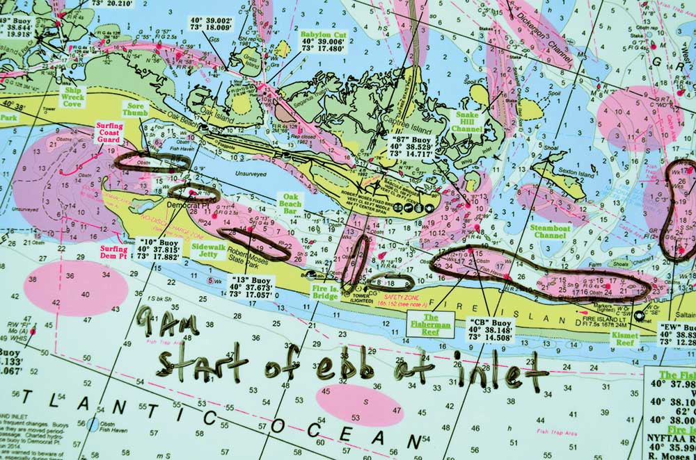
A milk run can easily be made by utilizing Capt. Segull’s laminated charts. The lamination not only serves as a protector, it also offers you the ability to use dry erase markers to map your day, then wipe off and plan again for a different day. Granted, rainy days will have you grumbling a bit with the marks, but simply covering the chart in regular cellophane will take care of that.
The Perfect Milk Run
In the fall, baitfish begin moving out of the bays on the outgoing tide, heading for South Shore inlets from Shinnecock to the Rockaways. Depending on the wind and tide, mapping out a milk run the day before can be crucial to success.
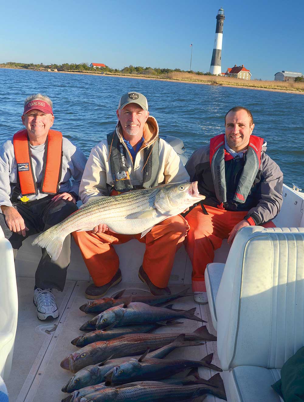
For example, let’s plot the day for this scenario. The tide will begin ebbing at 9 a.m. with a light wind out of the east in the Fire Island area. The plan is to live-line spot and bunker, in search of big bass. For argument’s sake, we already have bunker and spot in our livewell ready to go.
Bass will feed throughout the tide, but planning will allow you to optimize your efforts in the best areas based on the tide stage. For this day, I want to be at various spots during the first two hours of the ebb. The ebbing tide will begin at the inlet, then be later as we work our way east.
For this scenario, combined with the east winds, I want to fish the rocks near the Sore Thumb area. As the current increases, I want to begin pushing inside the bay, stopping next at the old sidewalk jetty area, then the Ranger Station. From this point, I want to hit the pilings at the Moses Bridge, then work my way to the front of the Coast Guard Station and the area from The Fisherman Reef to Kismet Reef, where West and Dickersons channels converge. By mapping this out on a chart, complete with times, you can ensure you hit the given spots, a.k.a. milk run, at the best possible tide stage to score a few fish.
This scenario will play well around many parts of the Island, including the Peconic Bays, Shinnecock and Moriches bays, the West End bays, Jamaica Bay, Manhasset Bay, Hempstead Harbor, Smithtown Bay and the North Fork. I am sure if you take a look at any of the Capt. Segull Charts for your area, you could map out a similar run as I did for Great South Bay. The same approach can also be used when targeting other species like fluke, weakfish, sea bass, blackfish or any other species for that matter.
Safety Too
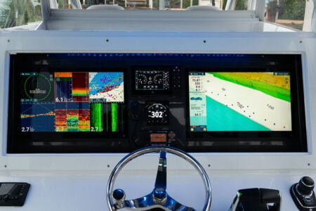
Having a good chart on the boat is not only going to help you with catching fish. They will also aide in locating shoals, sand bars and rocky areas that could result in damage to your boat, or worse yet, put you in grave danger. I know, and I have heard it time and again from anglers at shows and on the water. “I do not need charts of any given area because I know the area like the back of my hand, plus I have the latest electronics available. In fact, my electronics are so good, they could get a blind guy back to the dock.”
Speaking of blind, have you ever been on the water when a wicked, dark, wind-blown torrential rain came in? How about pea soup fog? Or the worse-case scenario, your prized electronics malfunctioned and are not working? I can tell you this for sure; a waterproof chart of the area used in conjunction with a compass, which every boat should have regardless of your electronics, will ensure your safe return and keep you from landing many miles from your intended destination. When caught in a bad situation such as thick fog, knowing the area like the back of your hand will be of little help since you can easily become disoriented.
The bottom line is keeping a chart on your boat for the areas you fish is a wise choice. They are a cost effective way to improve your success at the fishing game, and also provide an extra measure of insurance when it comes to getting you home safely. They will aid in navigation if needed, help you plot your fishing day, and allow you to do some pre-season strategizing before the spring fishing takes hold. Before the season gets underway, stop by your local shop and pick up a Capt. Segull Chart of the area you plan on fishing, and study it. Remember, preparation is the key to success.
Capt. Segull Charts
www.captainsegull.com
cathyhadad@suddenlink.net
888-473-4855