Breaking down weather tools and real-world judgment anglers can use to make the critical call between heading offshore and staying at the dock.
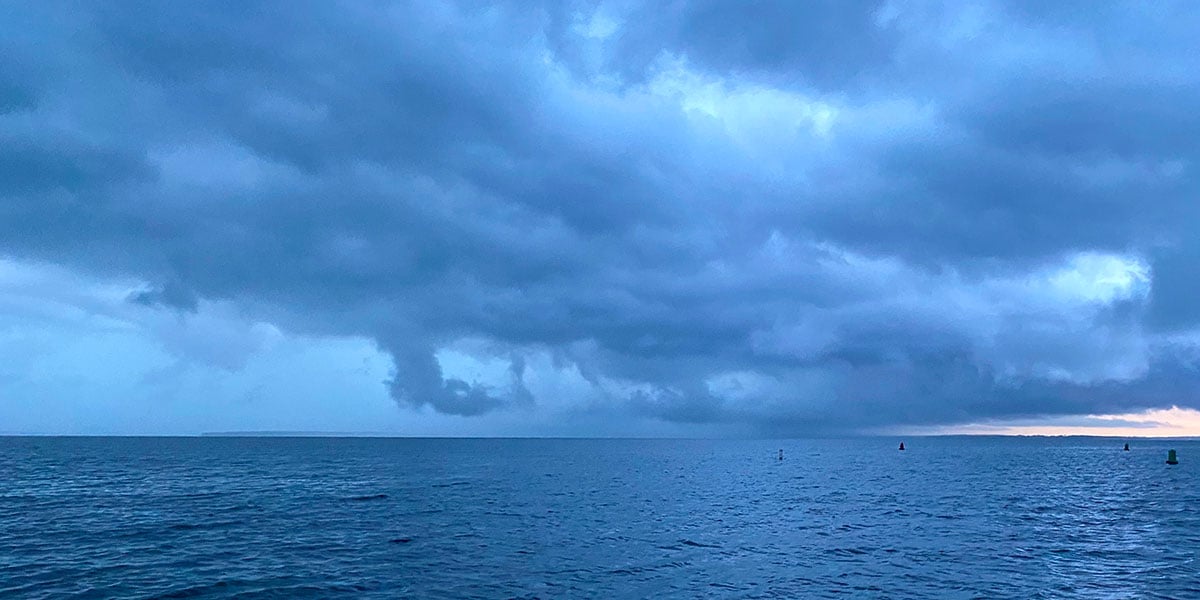
It was a typical fall Saturday morning in October, when alphabet storms march up the Atlantic seaboard with an incessant cadence, impacting coastal waters and weather patterns for hundreds of miles in every direction. I was standing on the docks talking with fellow charter boat captain Bobby Tyree of the Jay-Mar about the hot tuna bite near the Tip of the Hudson, some 65 miles offshore, and our crews were itching to get a piece of the action. With low, gray scud clouds racing across the sullen skies, we were both considering the same question: go or no-go?
Capt. Bobby’s 35-foot Grumman Sea Hawk was a solid, 20-knot, twin-diesel fiberglass workboat originally designed to service offshore oil rigs, so he was comfortable making the trip. My 22-year-old 27 Phoenix Express had more speed, with a 28-knot cruise powered by twin Mercury 200 OptiMax outboards, but rough ocean seas will always slow you down.
“The marine weather forecast has a northeast wind moving this storm system out, and the eastern skies are starting to clear up a bit,” Capt. Tyree remarked. I was listening to the same updated marine forecast, but I knew that a freshening northeast wind 65 miles from land was going to build some interesting sea conditions, especially on the ride home in the dark.
“My guys want to go and I’m heading out,” he said, but I opted to wait a little longer before making the final call. “If I’m going, I’ll call you on the VHF and will probably pass you somewhere between the Linda and the Virginia,” I replied.
Roughly 20 minutes after the Jay-Mar left the docks, my crew was still gung-ho for the trip and the weather looked like it might be clearing as forecast, so we shoved off. It was definitely a “sporty” ride out to the edge, especially after clearing 20 fathoms and losing the lee of the land. We plowed ahead at 19 knots and eventually caught up to the Jay-Mar near the east side of the Hudson Canyon’s Notch.
We both enjoyed a great catch of yellowfin and bluefin behind the draggers, but it almost didn’t happen. That trip still raises an important question: At what point do crew safety and potentially compromising weather patterns outweigh the temptation of heading offshore for a hot tuna bite?
Informed Decisions
It’s been about 25 years since that go/no-go conversation at the Babylon Fishing Station, and there have been many more weather calls made since then, some clairvoyant and others not so smart. The biggest difference between now and then is technology. Boats are built better, utilize superior construction materials, travel faster and have more range. Marine electronics have advanced light-years from the early 2000s, with many vessels now equipped with SiriusXM Marine modules for real-time weather and storm updates. Safety equipment has also advanced with EPIRBs, PLBs, electronic emergency flares and satellite communication devices such as Garmin’s inReach.
One of the most game-changing tools available to coastal anglers is the growing number of weather apps designed for smartphones and tablets. Programs such as Windy, Windfinder, Windguru, WindUp, WindAlert and Buoyweather complement traditional sources such as NOAA’s National Weather Service Doppler radar, the National Data Buoy Center and local and offshore marine forecasts, including SiriusXM Marine.
Most weather apps offer both free and fee-based versions, so the level of sophistication, forecast range and customization you need might come with an additional price tag. The important part is learning what each source provides and comparing multiple forecasts before making a final decision.
NDBC
NOAA’s National Data Buoy Center is always one of my first stops when planning a trip. Eastern Long Island’s nearshore weather buoy 44017 broke free of its mooring tether a few years ago and was eventually recovered in 2023. According to NOAA, data will be restored during a future service visit.
In the meantime, I use information generated from buoys 44025, located about 30 miles south of Islip; 44065, roughly 15 miles southeast of Breezy Point; and 44066, on the western flats of the Hudson Canyon about 75 miles east of Long Branch, New Jersey.
The tracking graph on buoy 44025’s home page includes a five-day plot for wave height, dominant wave period, average wave period, mean wave direction and sea surface temperature. The data is updated roughly once an hour, making it about as real-time as you can get from a free government weather source.
The NDBC website also links to National Weather Service marine forecasts. One offers offshore forecasts from Maine to Sandy Hook and out to 1,000 fathoms, while another provides more localized forecasts out to 20 fathoms. Like any weather forecast, these can sometimes miss the mark, which is one reason I prefer comparing several sources before committing to an offshore run.
NWS Doppler Radar
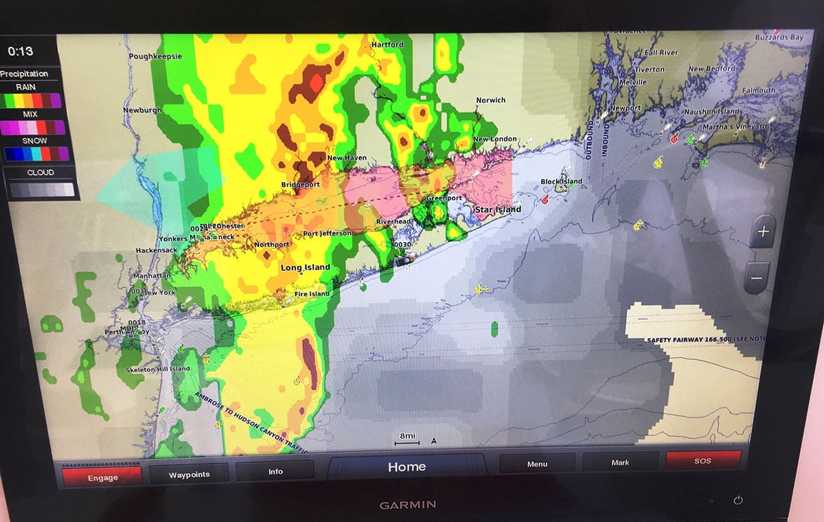
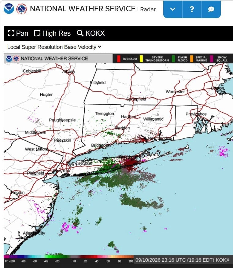
NOAA’s National Weather Service also offers real-time Doppler radar that allows users to track storm fronts and rain cells. Once on the website, you can zoom into your area of interest and get an updated bird’s-eye view of what is happening in the atmosphere. For anglers trying to determine whether a line of storms is moving toward or away from the coast, it can be an extremely useful tool.
I have hands-on experience using the free versions of Windy, Windfinder and Buoyweather on my iPhone, iPad, Android tablets and PC. Rather than rate them according to my personal preferences, here is a condensed look at what each offers, along with a few other apps worth considering.
Windy
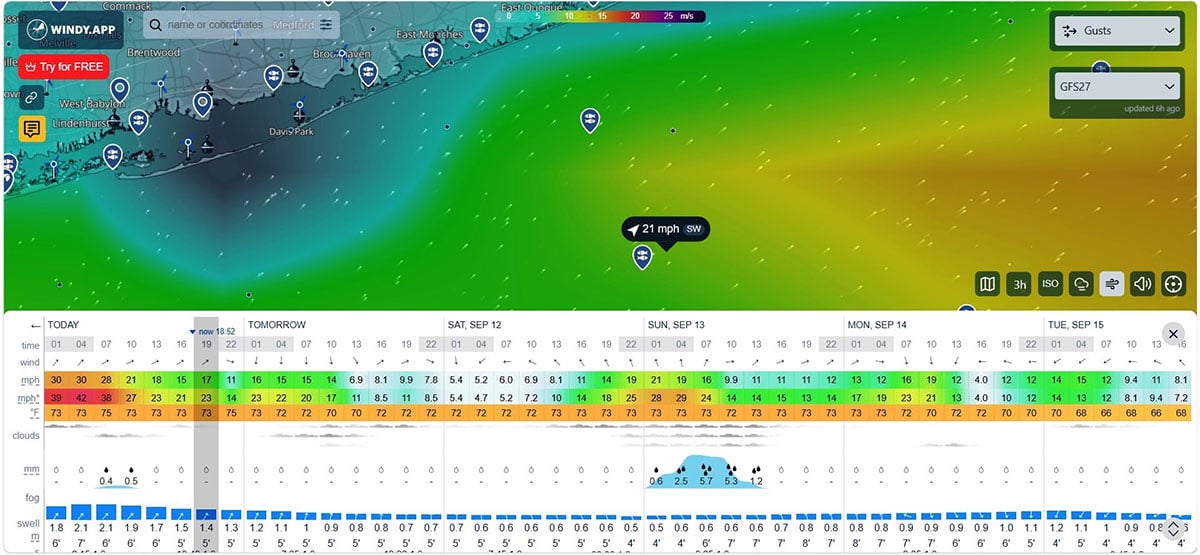
The Windy app is a professional weather app designed for sailing, surfing, fishing and other wind-and-water-based activities. Users can access detailed weather forecasts, live wind maps and local weather reports. The standard version is free, while the Pro version requires a paid subscription.
The free tier provides standard global weather models and basic information on wind speed, direction, gusts, air temperature, pressure and precipitation. It also offers live wind and rain maps, weather history and the ability to save favorite locations.
The Pro version unlocks additional high-precision global and regional models, higher-resolution forecasts, hourly breakdowns, expanded weather archives, specialized marine overlays and offline capabilities. For anglers who regularly travel offshore, the ability to compare models and study longer-range trends can be especially valuable.
Windfinder
Windfinder provides 10-day wind and weather forecasts for locations around the world, along with real-time measurements from weather stations. Available information includes wind speed and direction, gusts, temperature, cloud cover, precipitation and air pressure. Wave height, wave period and tide information are also available for select coastal locations.
The free version includes animated wind maps, basic widgets and limited webcam access where available. Windfinder Plus adds its higher-resolution Superforecast, custom wind alerts, advanced maps, additional widgets and an ad-free experience. For coastal anglers, the combination of wind, wave and tide information makes it useful for both inshore and offshore planning.
Buoyweather
Buoyweather takes a marine-focused approach. The free version provides a short-range forecast with basic wind, wave and swell information for a selected point on the water. Users can enter a GPS latitude and longitude and get a forecast for that exact area.
The Premium version extends the forecast range and adds tools designed for offshore boaters, including a Captain’s Brief, sea surface temperature, bathymetry, satellite layers, high-resolution isobar charts and additional wind and wave models. Users can also save favorite offshore locations and routes. For canyon fishermen and anyone planning a long run, the ability to study a specific offshore point can be particularly useful.
WindAlert
WindAlert offers a basic free tier along with several paid membership levels. The free version relies on public weather data and standard forecast models while providing basic temperature, radar, satellite, precipitation and cloud-cover information. Users can also create lists of favorite public weather stations.
Paid memberships provide access to a larger network of weather stations, real-time wind monitoring, alerts and more advanced mapping tools. This can be useful for anglers who want highly localized wind observations or notifications when conditions reach specific thresholds.
Windguru
Windguru is another familiar option, especially among windsurfers, kitesurfers and other coastal users. Both the free and Pro versions provide access to updated forecast models, although the paid version offers greater customization for private or less-common locations.
If you simply want to check conditions at an established public location, the free version can provide plenty of information. Anglers who want to save specific coordinates or highly localized spots may find the Pro version more useful.
WindUp
WindUp focuses heavily on live wind monitoring and alerts. Its core features allow users to set thresholds for wind speed, direction and gusts, with alarms that can notify you when those conditions are reached. The app also draws information from thousands of live wind stations.
The paid version adds additional features, including tide information. For anglers whose trips depend heavily on a specific wind window, the ability to create custom alarms can save time and help catch short periods of favorable conditions.
The Final Call
No single app, buoy or forecast should make the decision for you. The best approach is to compare several sources and look for agreement among them. Check the predicted wind speed and direction, sea height and period, radar, buoy observations and the expected trend throughout the day. Just as important, consider what those conditions mean for your specific boat, crew and destination.
A 15-knot wind might be manageable in one direction and miserable in another. A forecast that looks acceptable close to the beach can become a completely different situation 50 or 60 miles offshore. Likewise, a comfortable ride out does not guarantee a safe ride home if the wind is expected to increase or shift later in the day.
Experience also matters. Technology gives us more information than ever, but it does not replace common sense or seamanship. Know the capabilities and limitations of your boat, motors and electronics. Keep your safety equipment current and readily accessible, and make sure everyone aboard understands the plan if conditions deteriorate.
However you source your weather information, the fickle fall weather patterns associated with tropical systems are no joke. Conditions can change quickly, especially offshore. Be sure your boat, motors and electronics are up to the task, have your safety gear updated and ready for immediate deployment, and remember the most important advice I can share: No fish is worth compromising the safety of you and your crew. There will always be more fish to catch another day.